

THE PEOPLE OF THE KEYHOLE TOMBS IN TASSILI

|
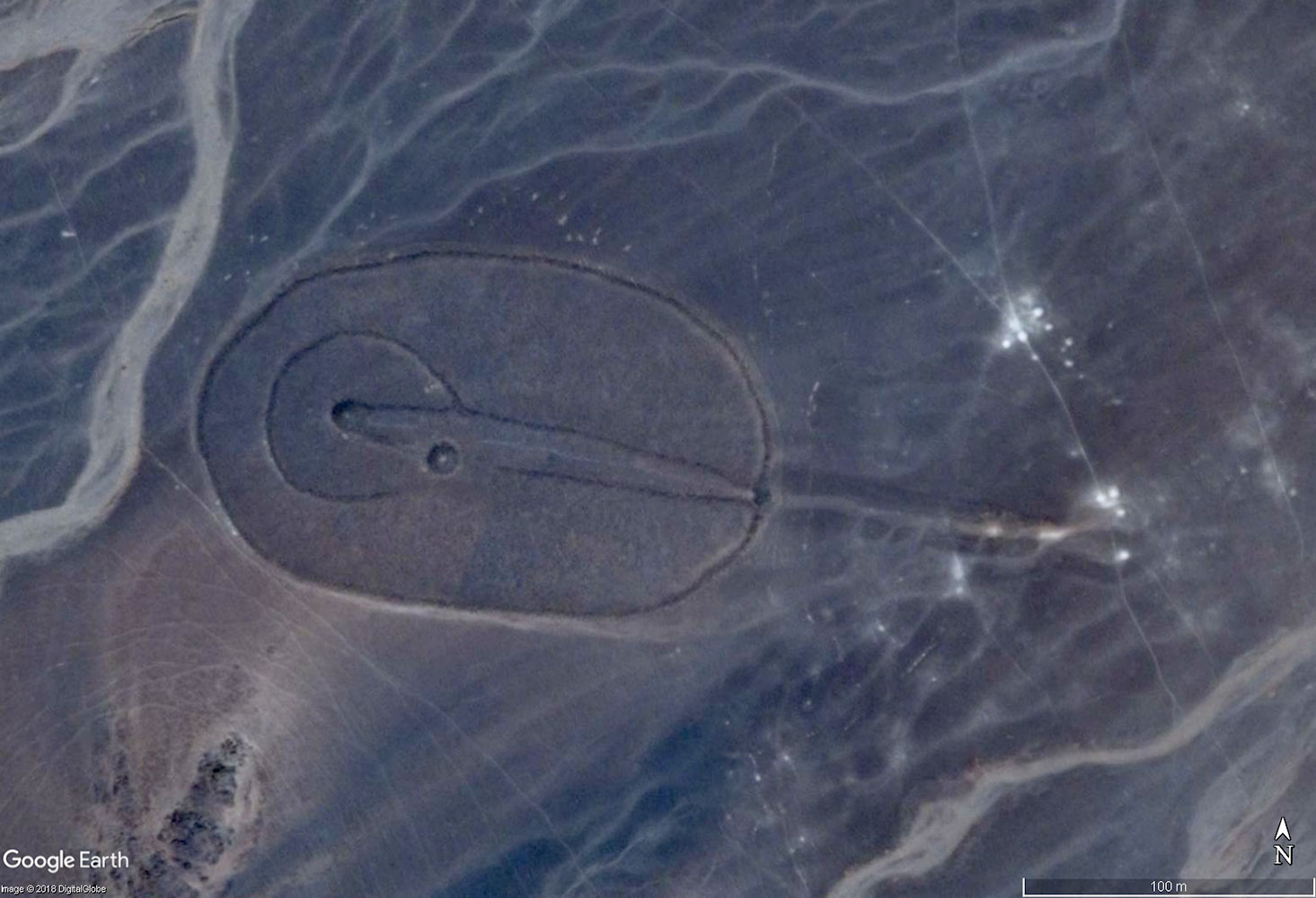
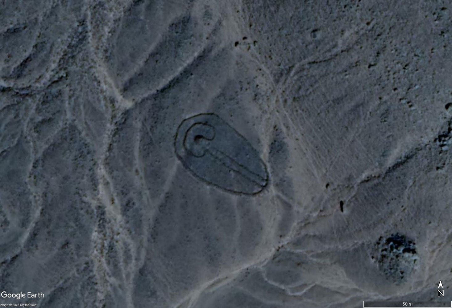
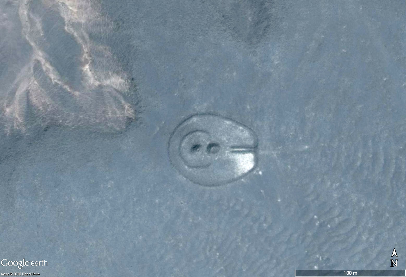
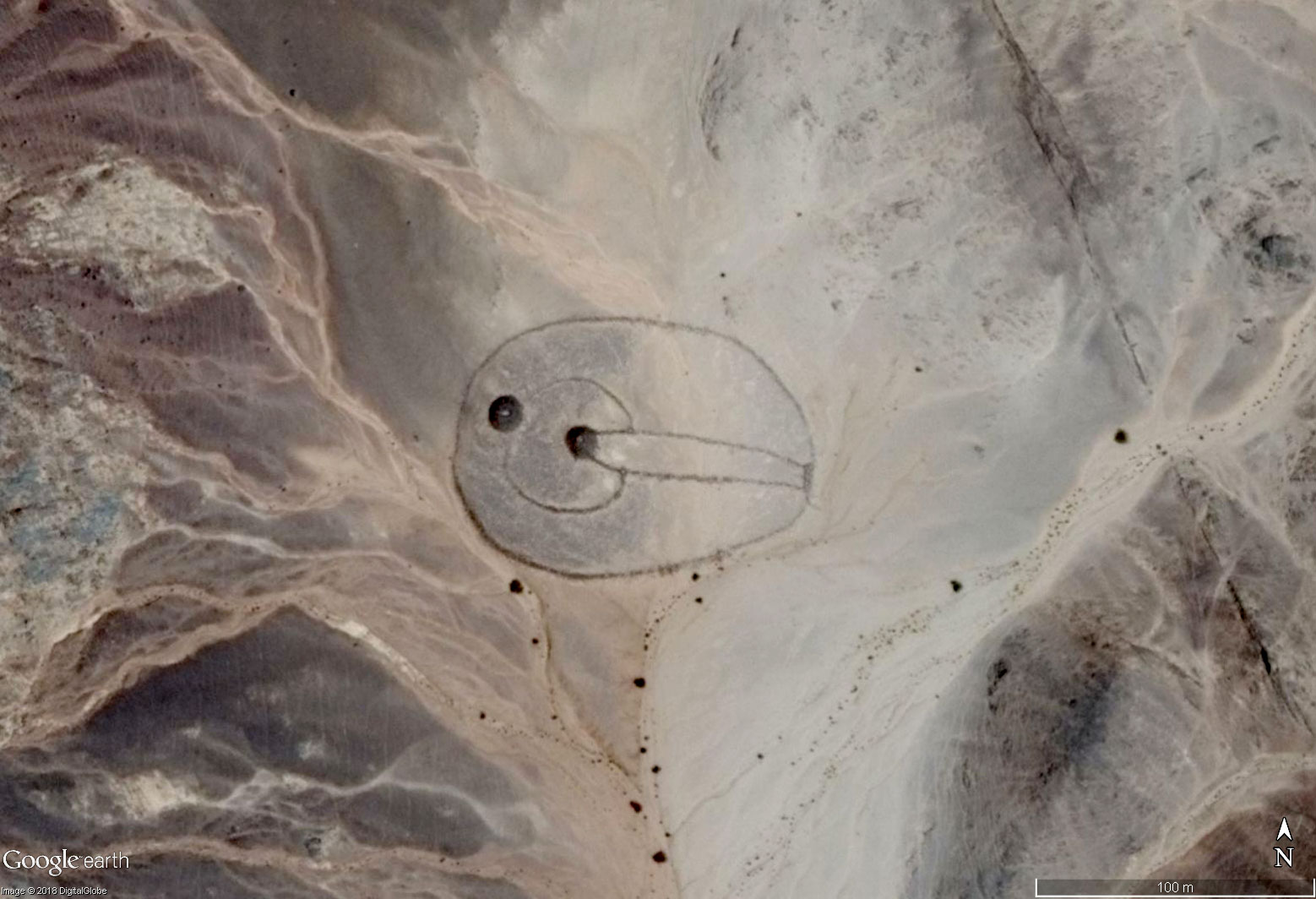
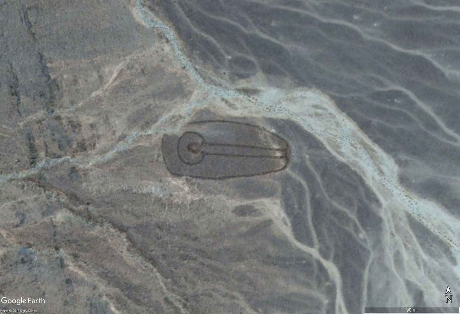
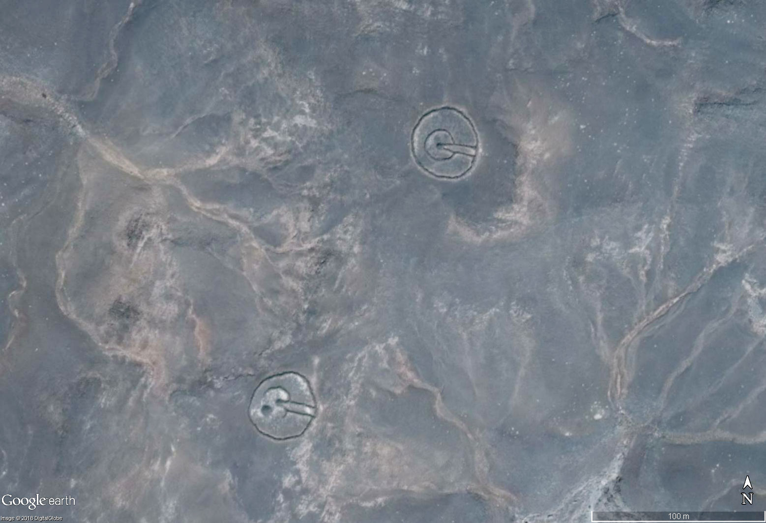
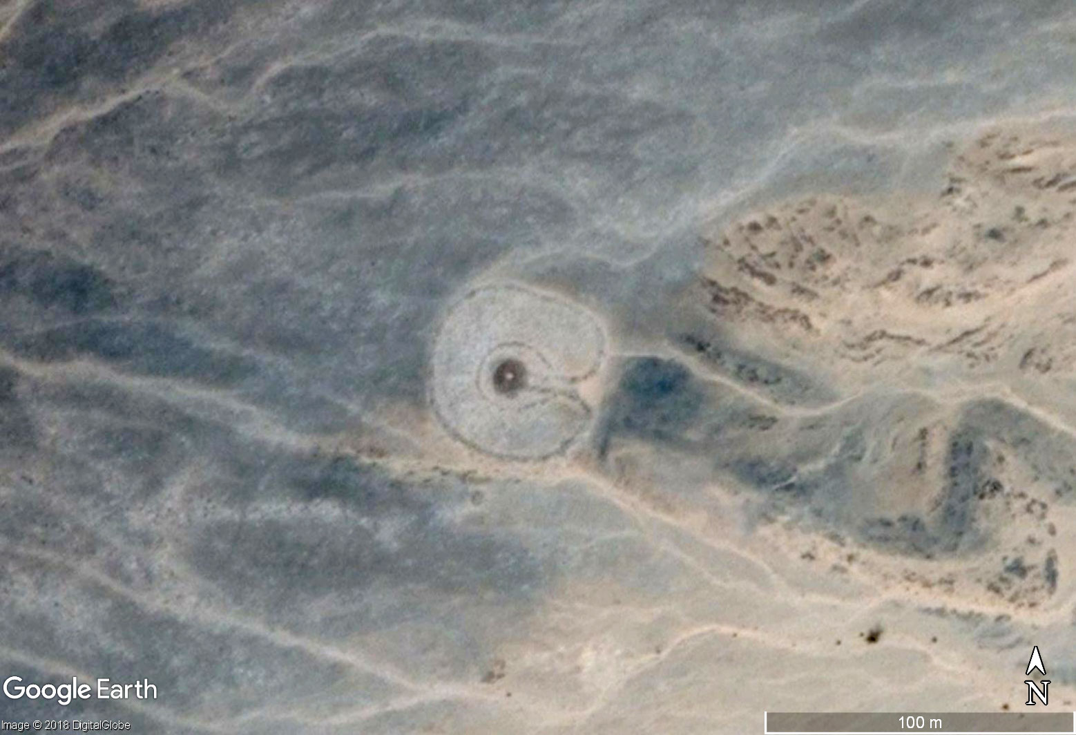
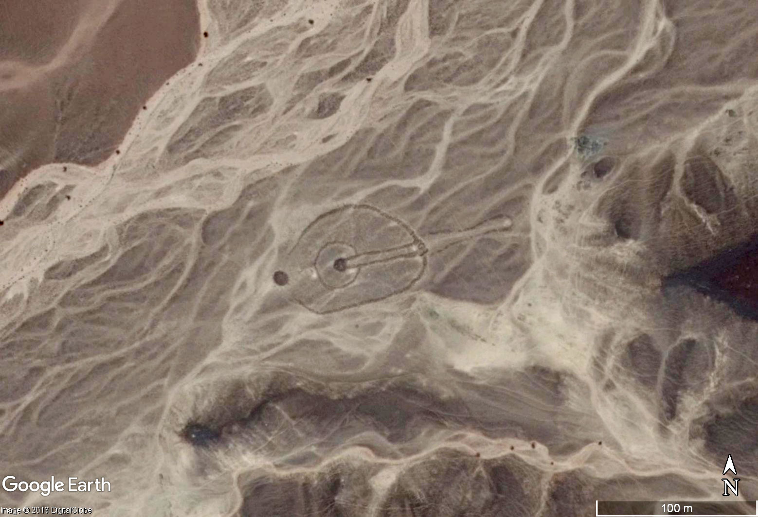
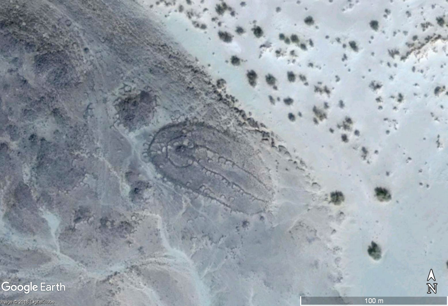
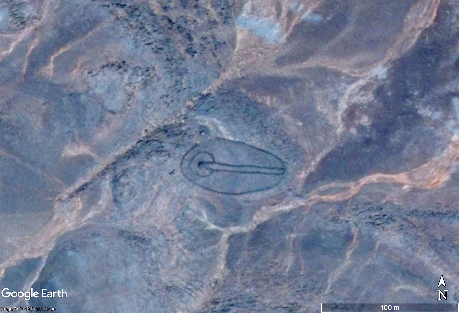
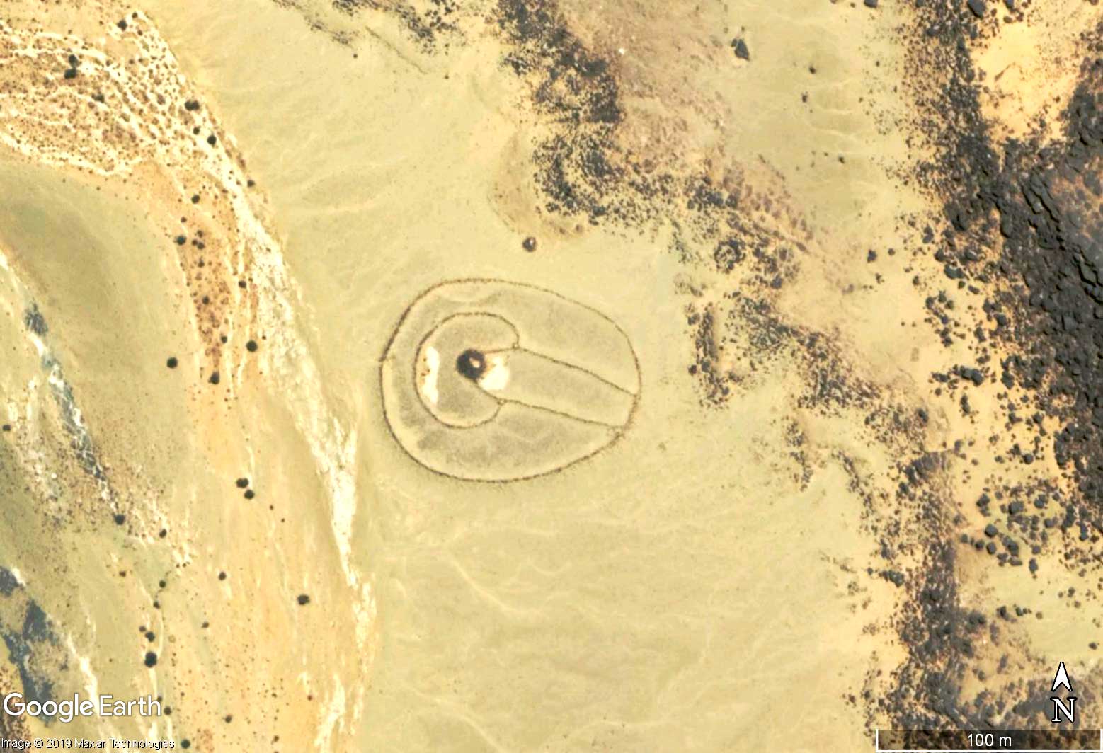
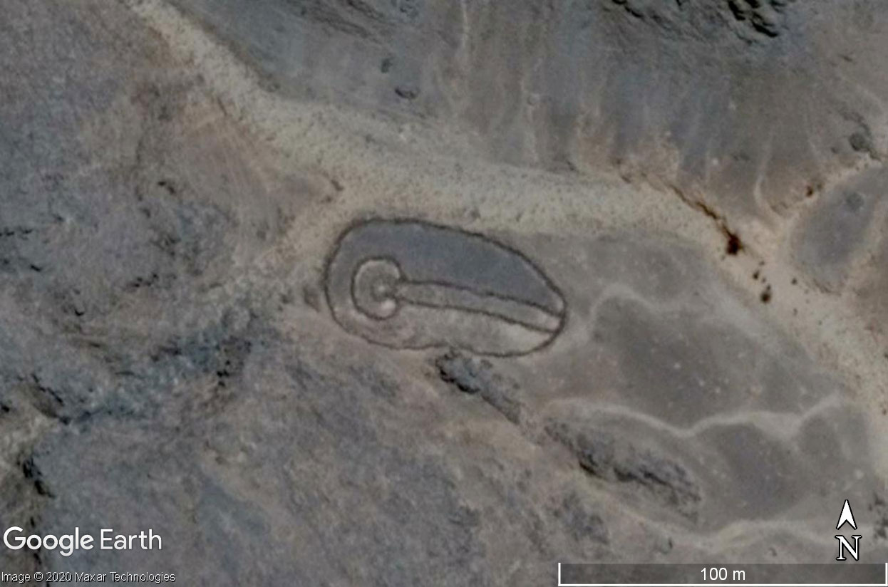
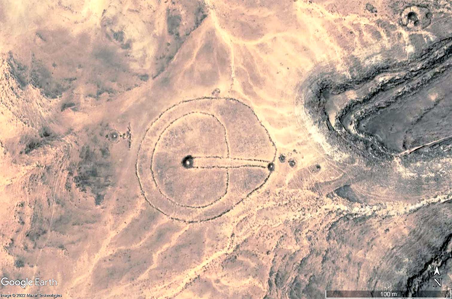
This keyhole monument, with a lenght of 200 m is the biggest as far as we know. (Thank you to Susan und Stephan of cantone-libero.ch, for providing the photo.) See in Google Maps >
We know comparatively much and yet little about a people who lived in the Tassili n'Ajjer, in south-eastern Algeria, around ten thousand years ago. A lot, because they left us a lot of rock paintings in which we can leaf through like a picture book. Little, because we still don't know who these people were, where they disappeared to and whether the striking stone monuments we find in the rocky central Sahara were built by them or by other peoples who once lived here.
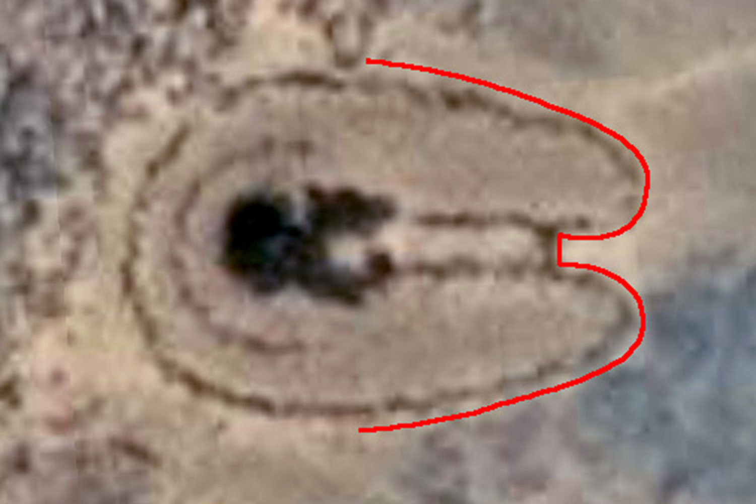
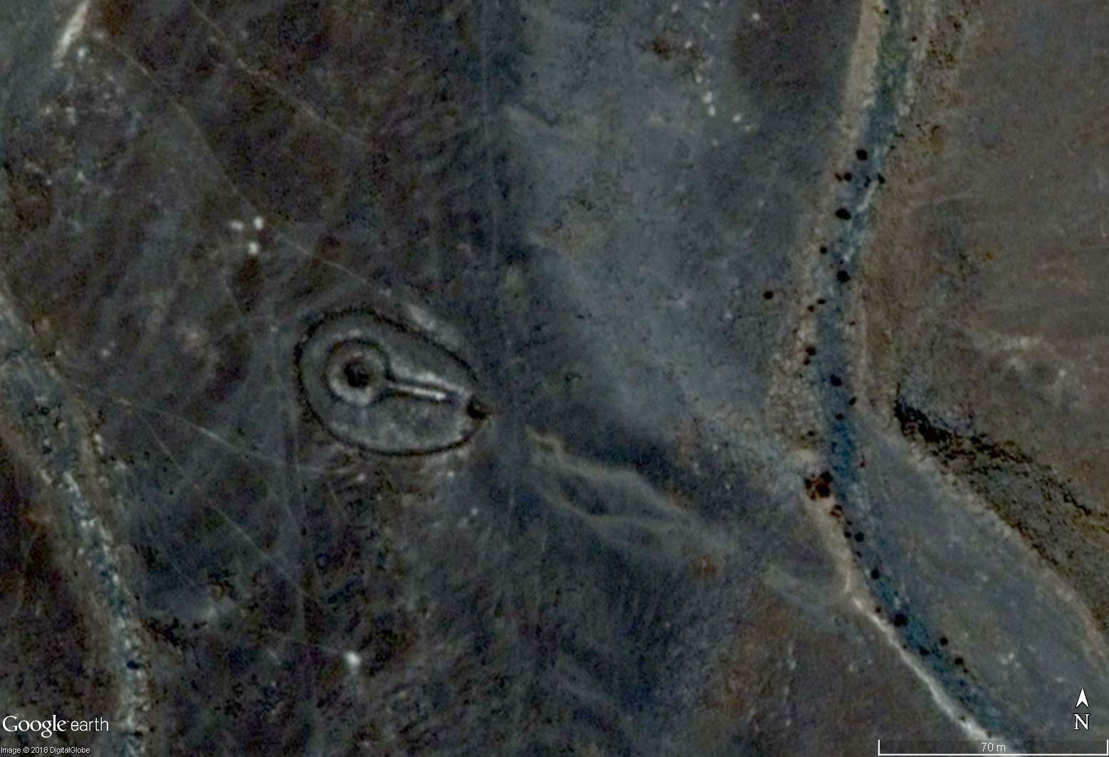
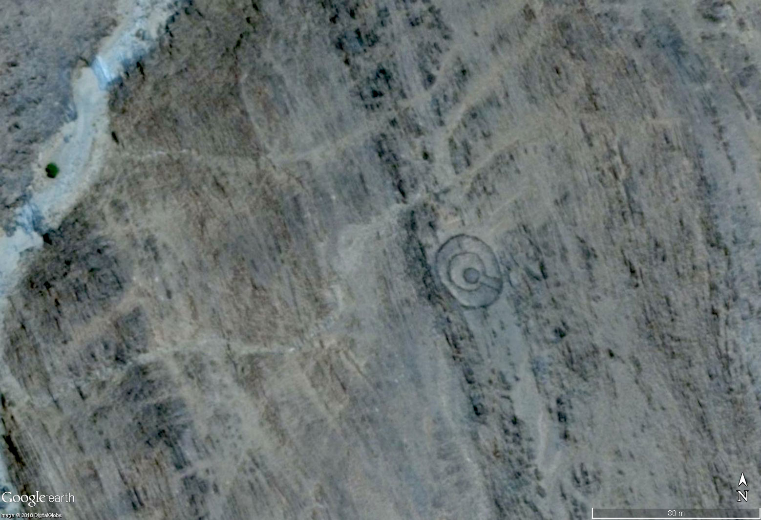
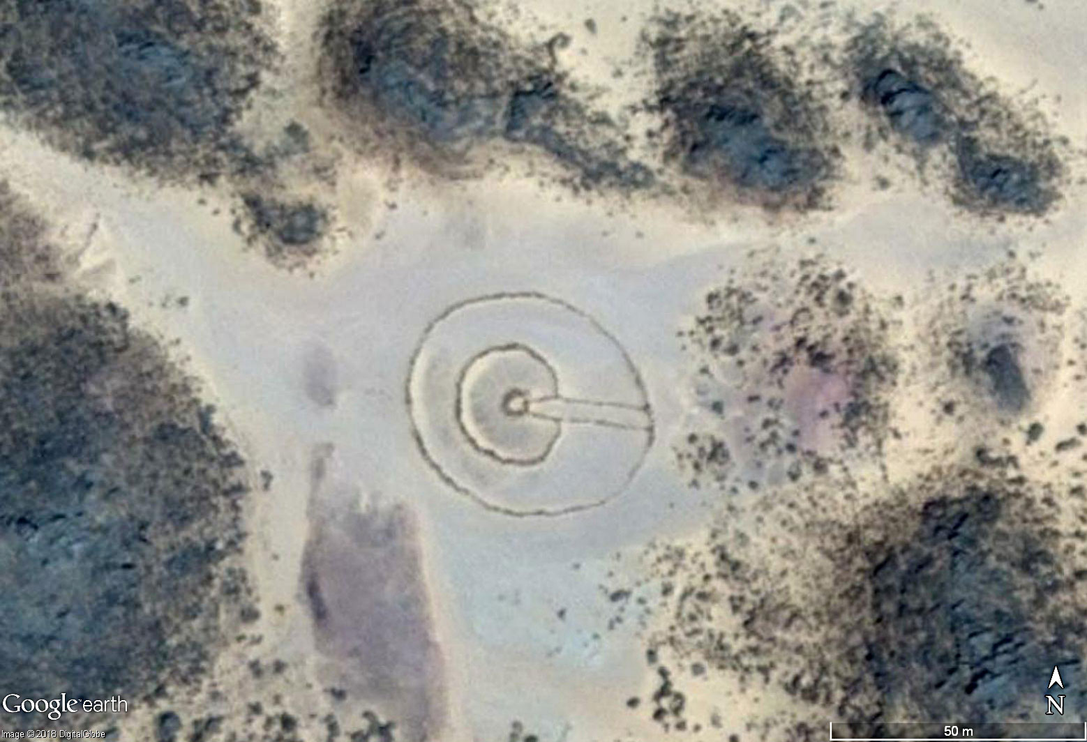
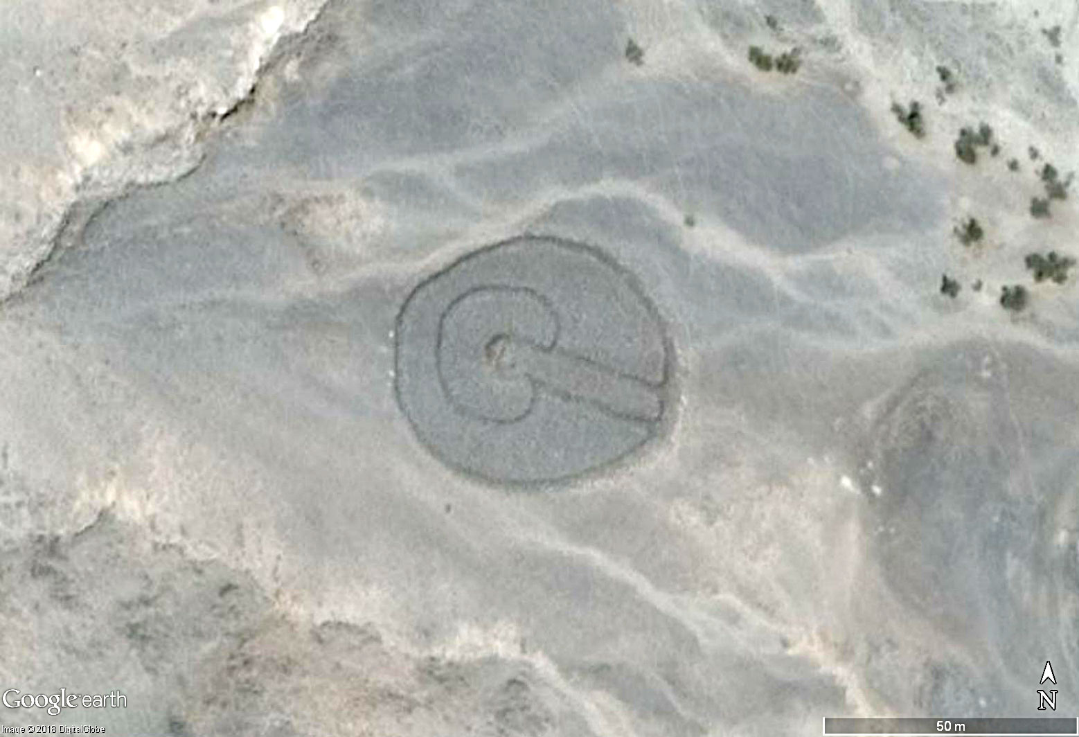
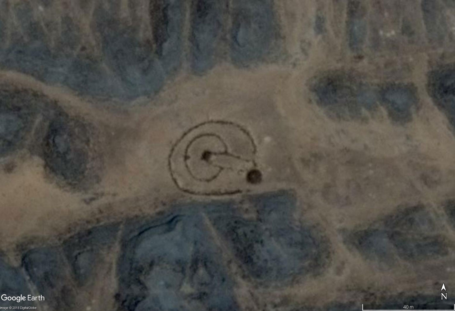
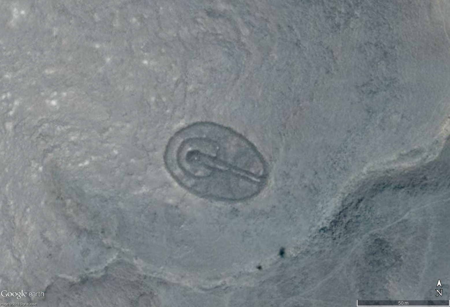
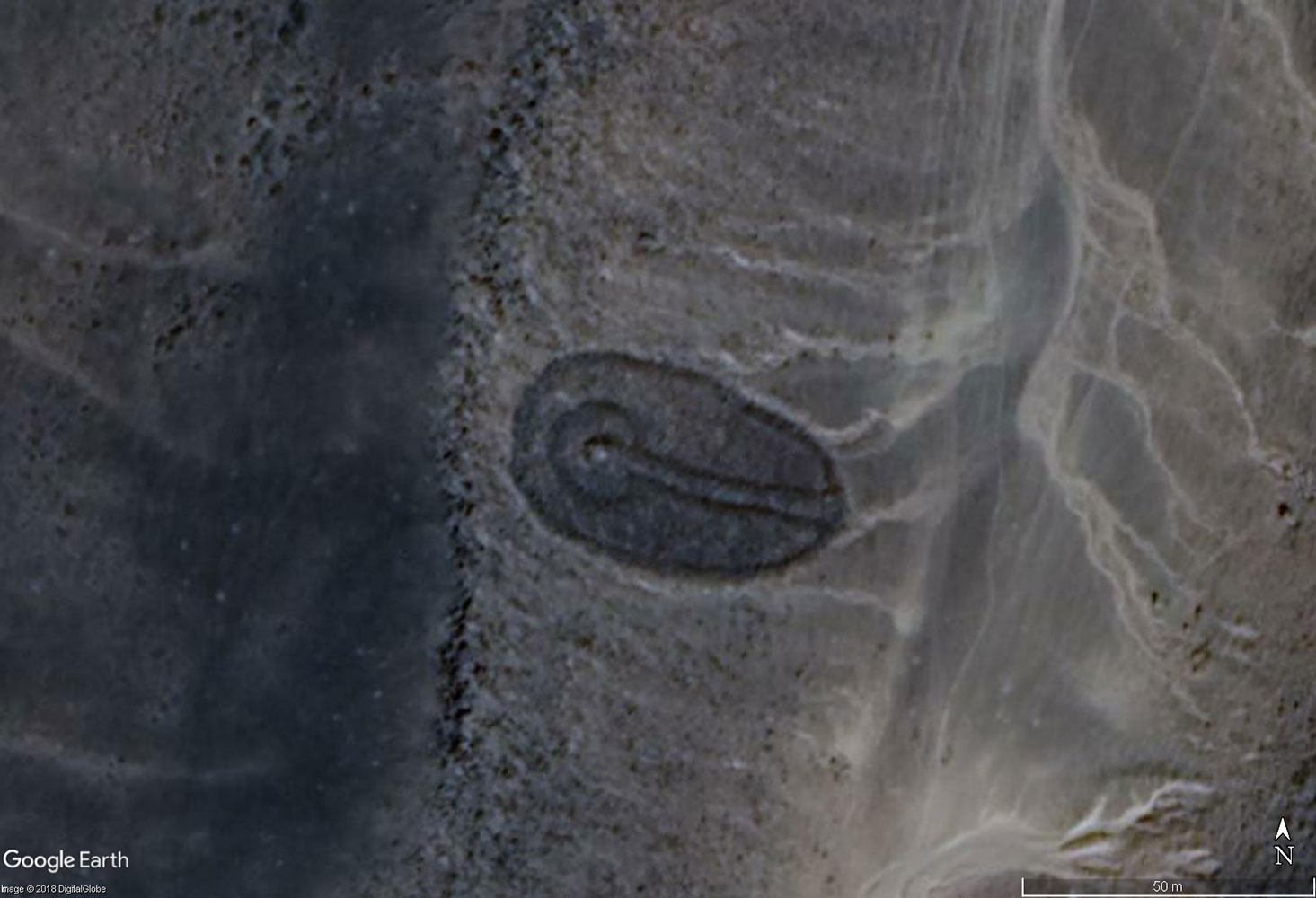
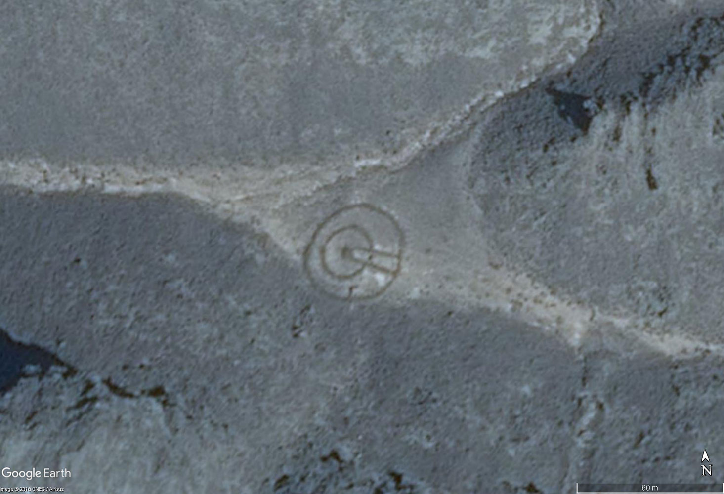
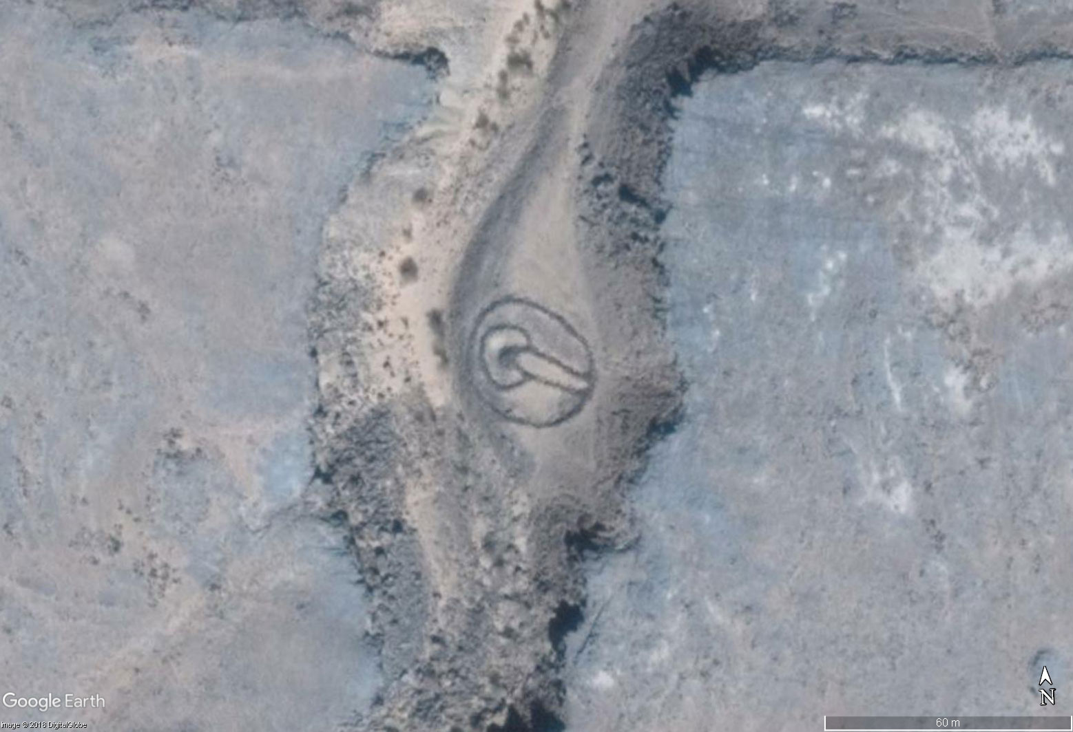
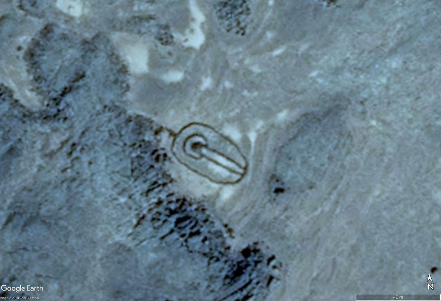
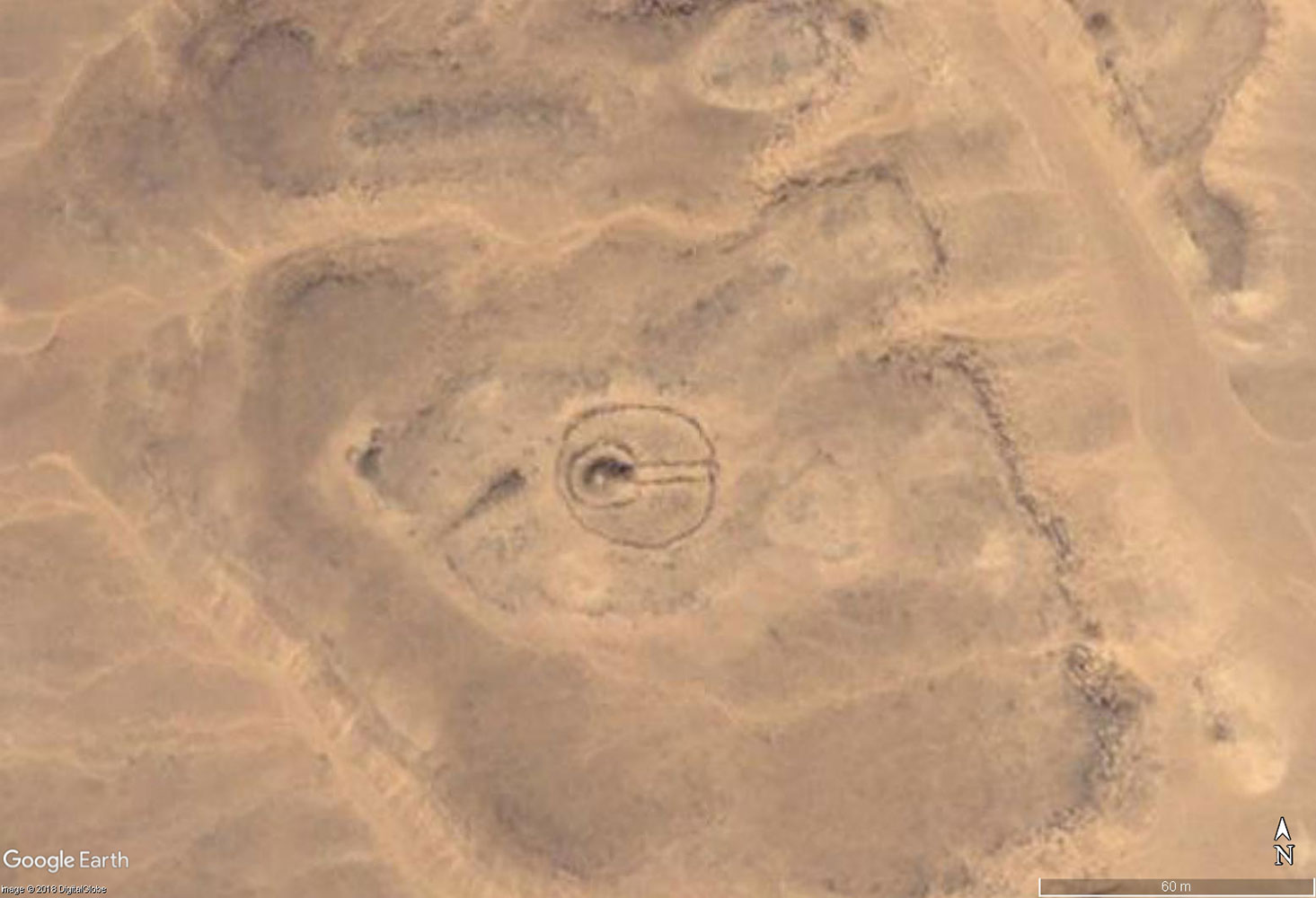
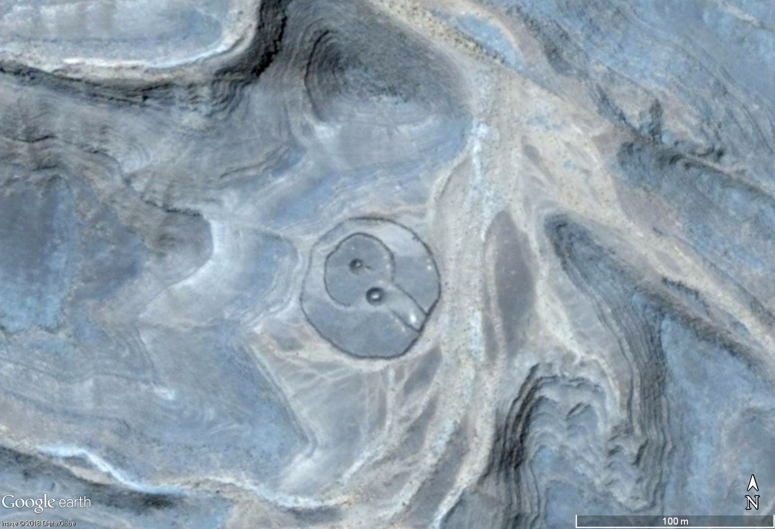
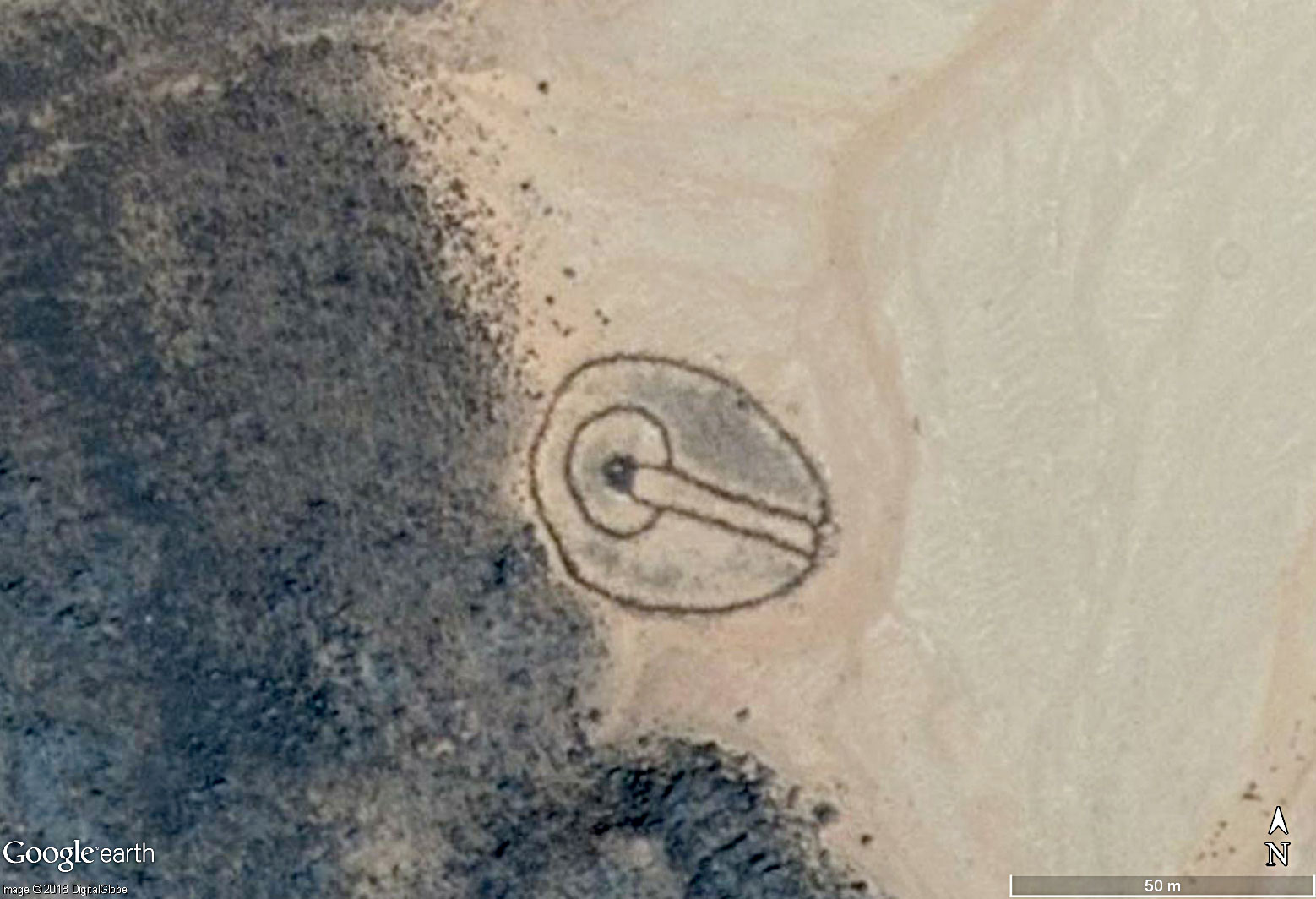
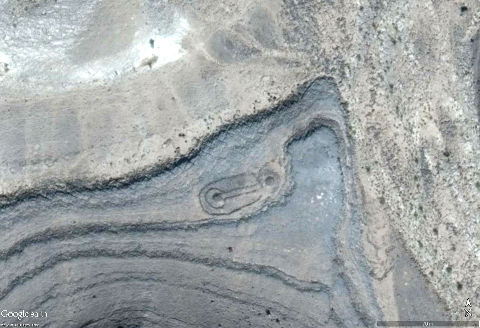
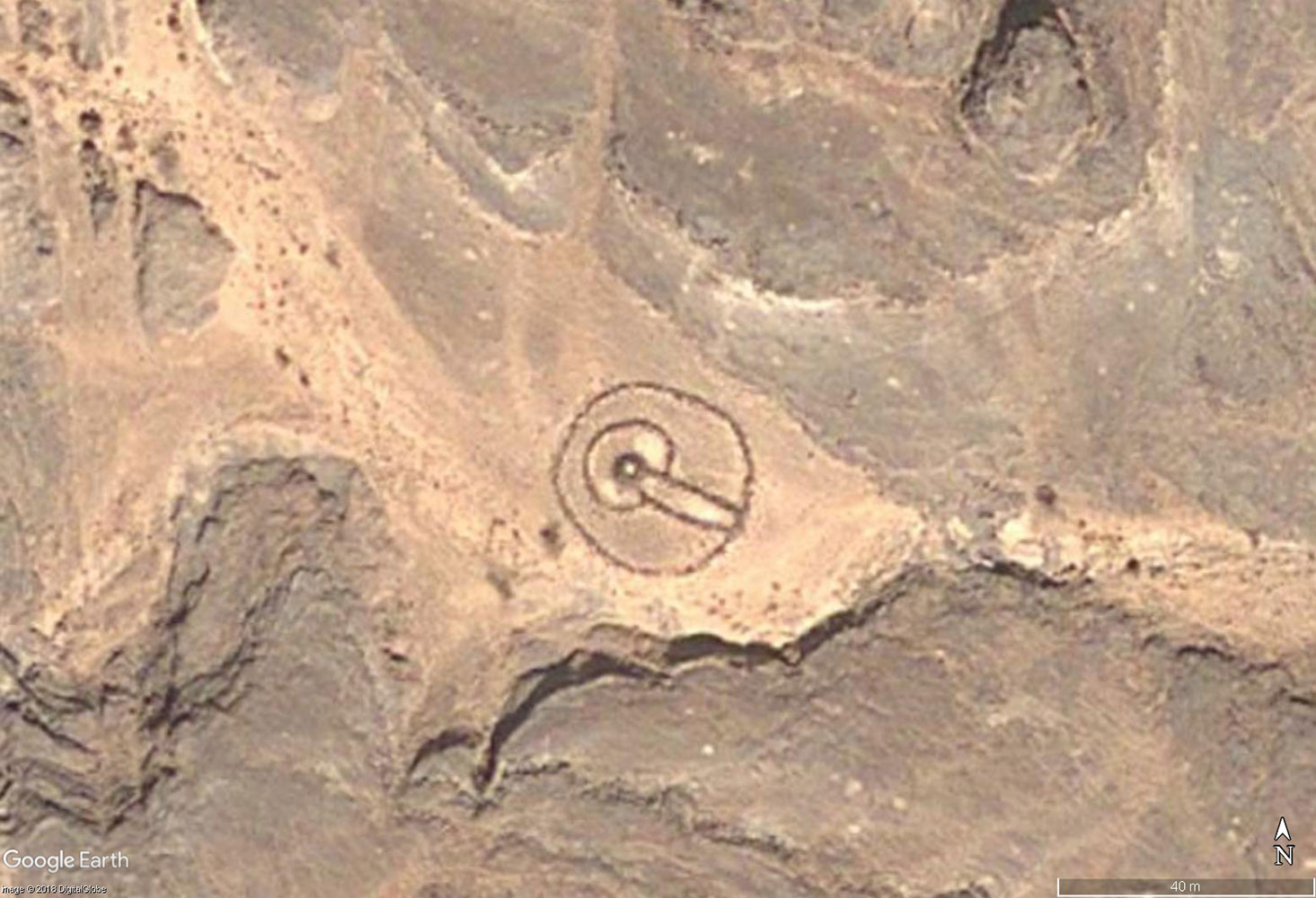
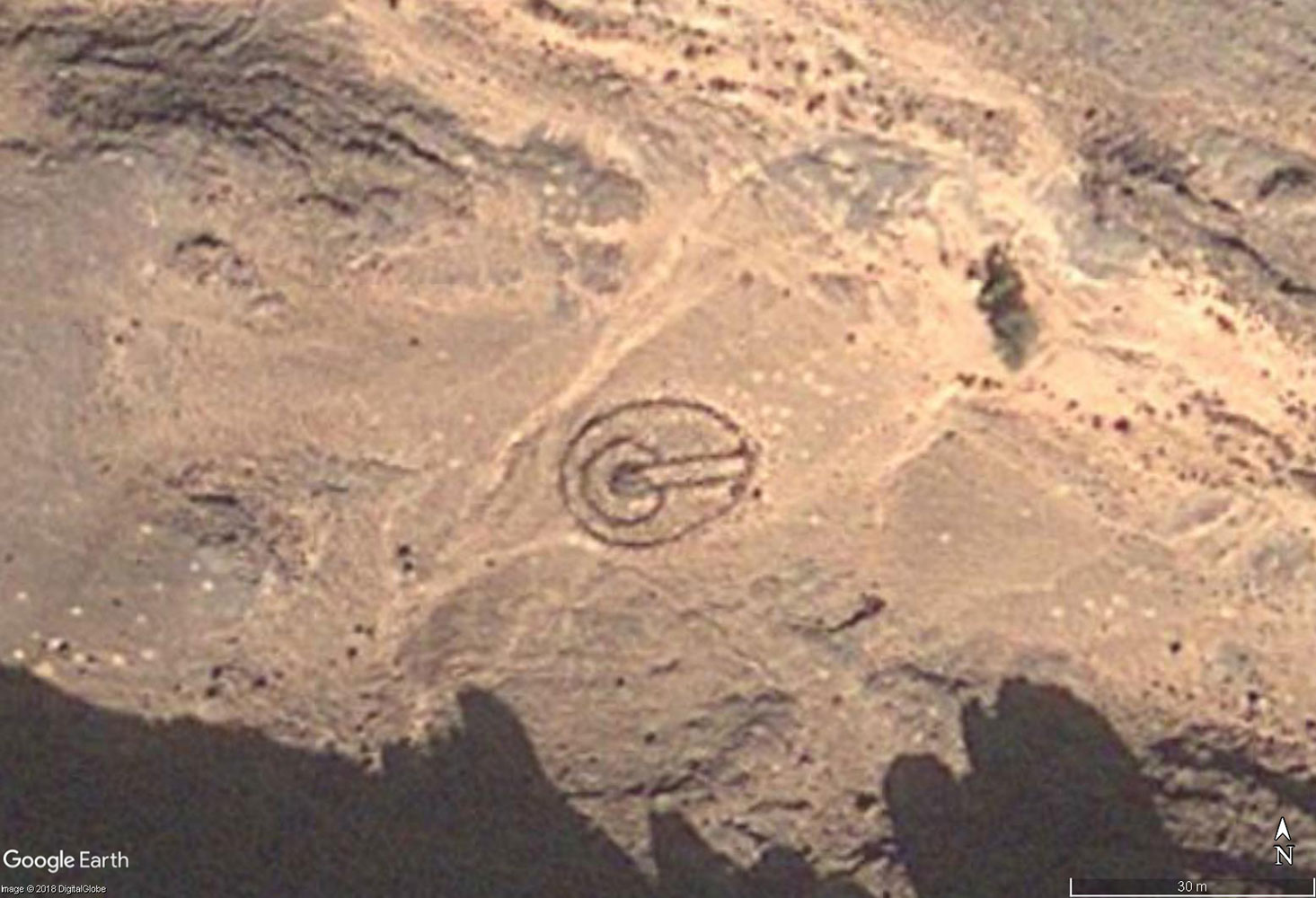
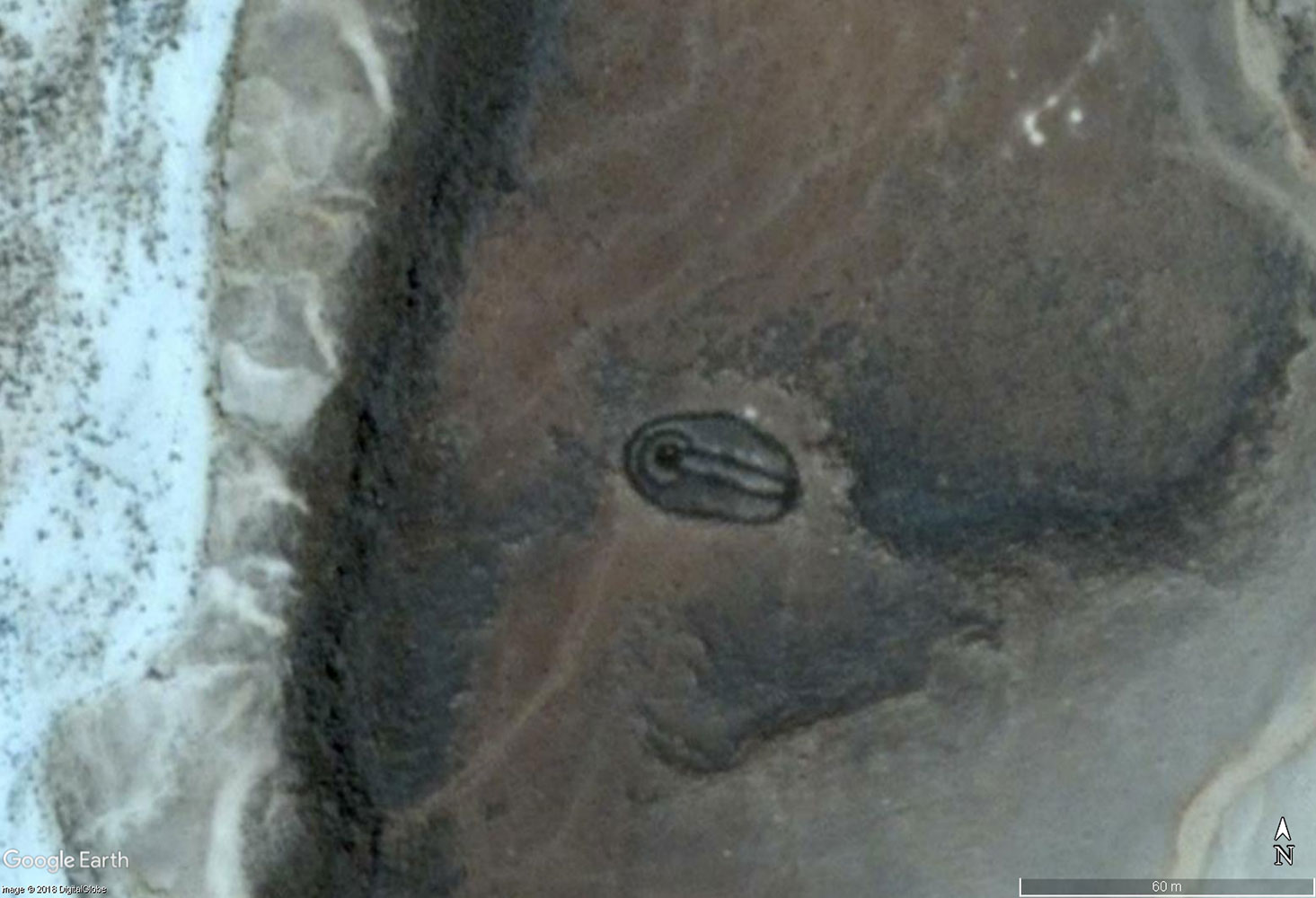
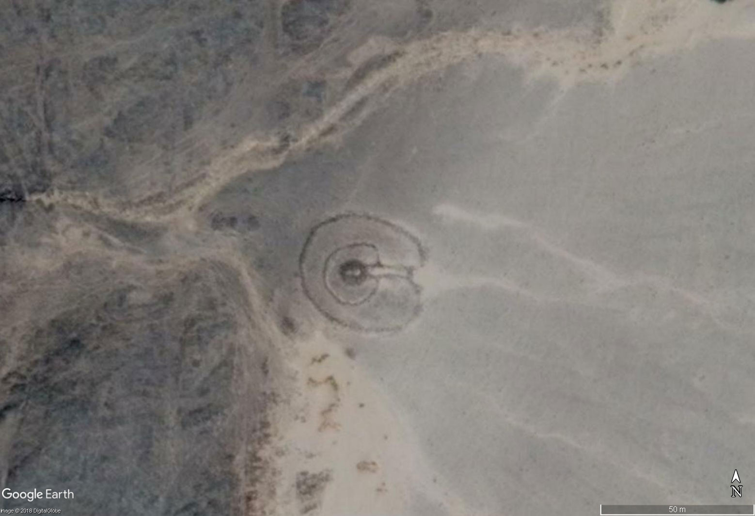
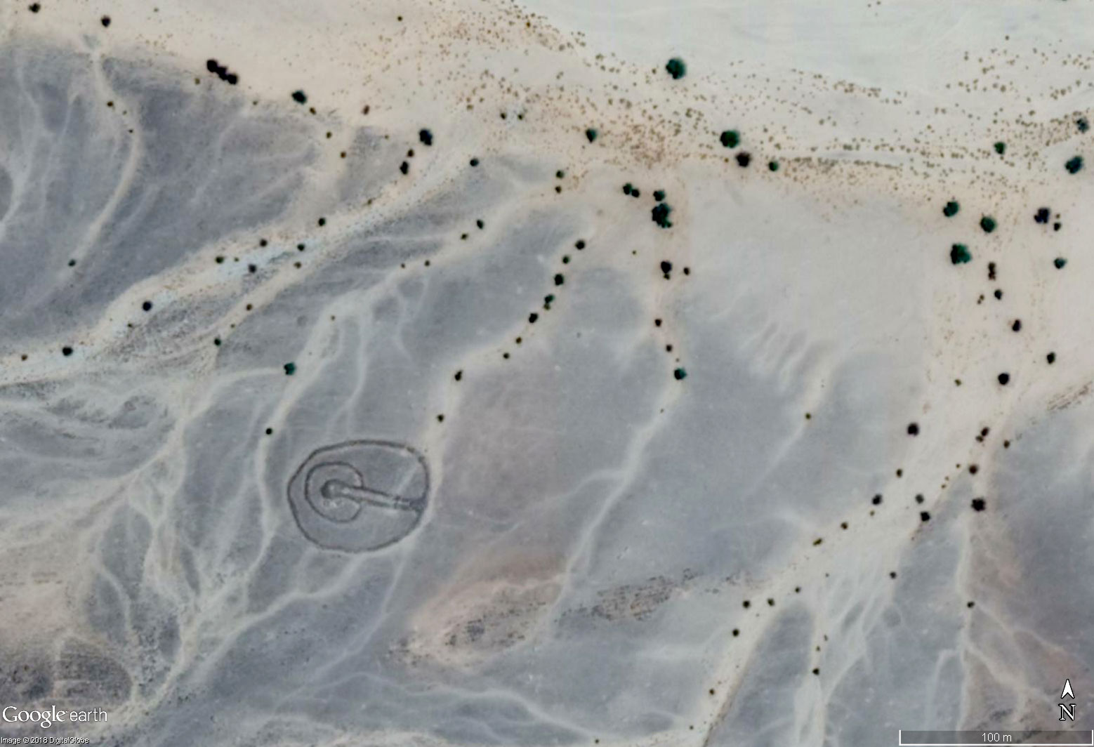
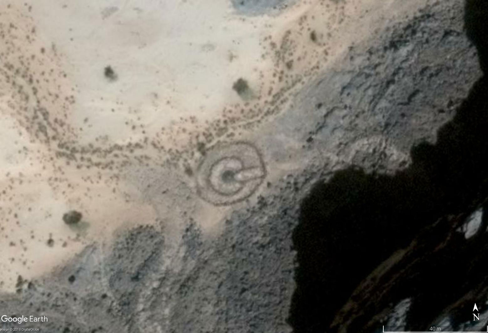
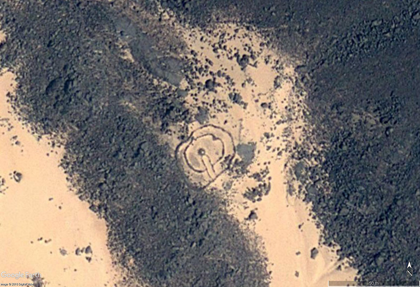
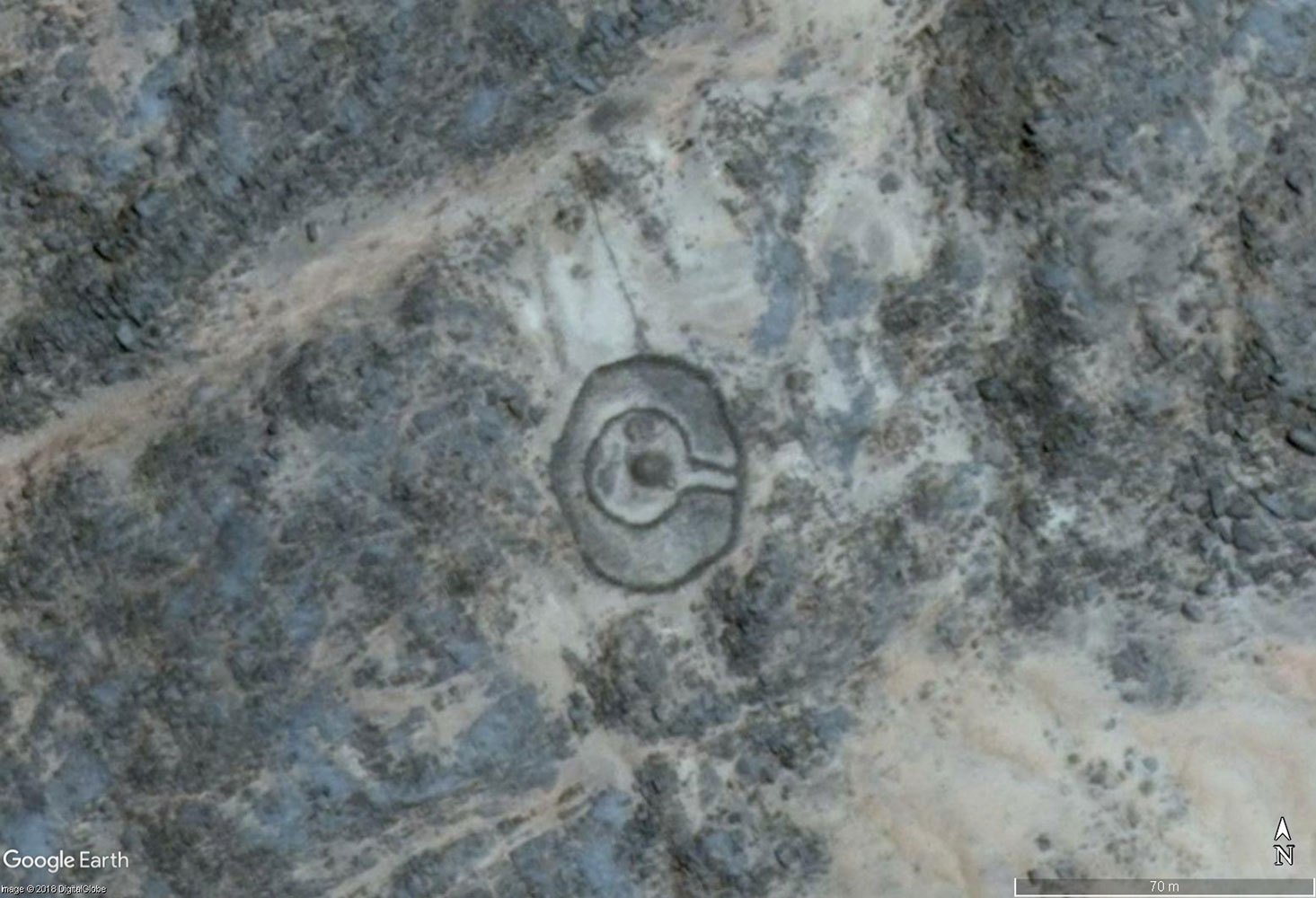
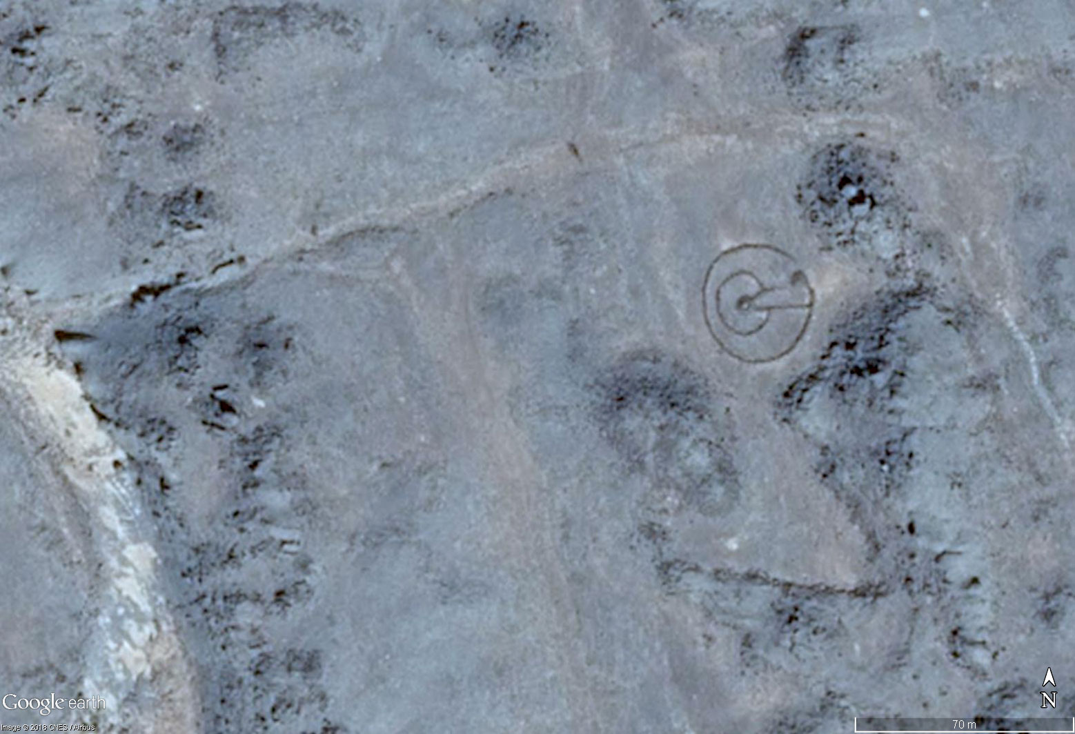
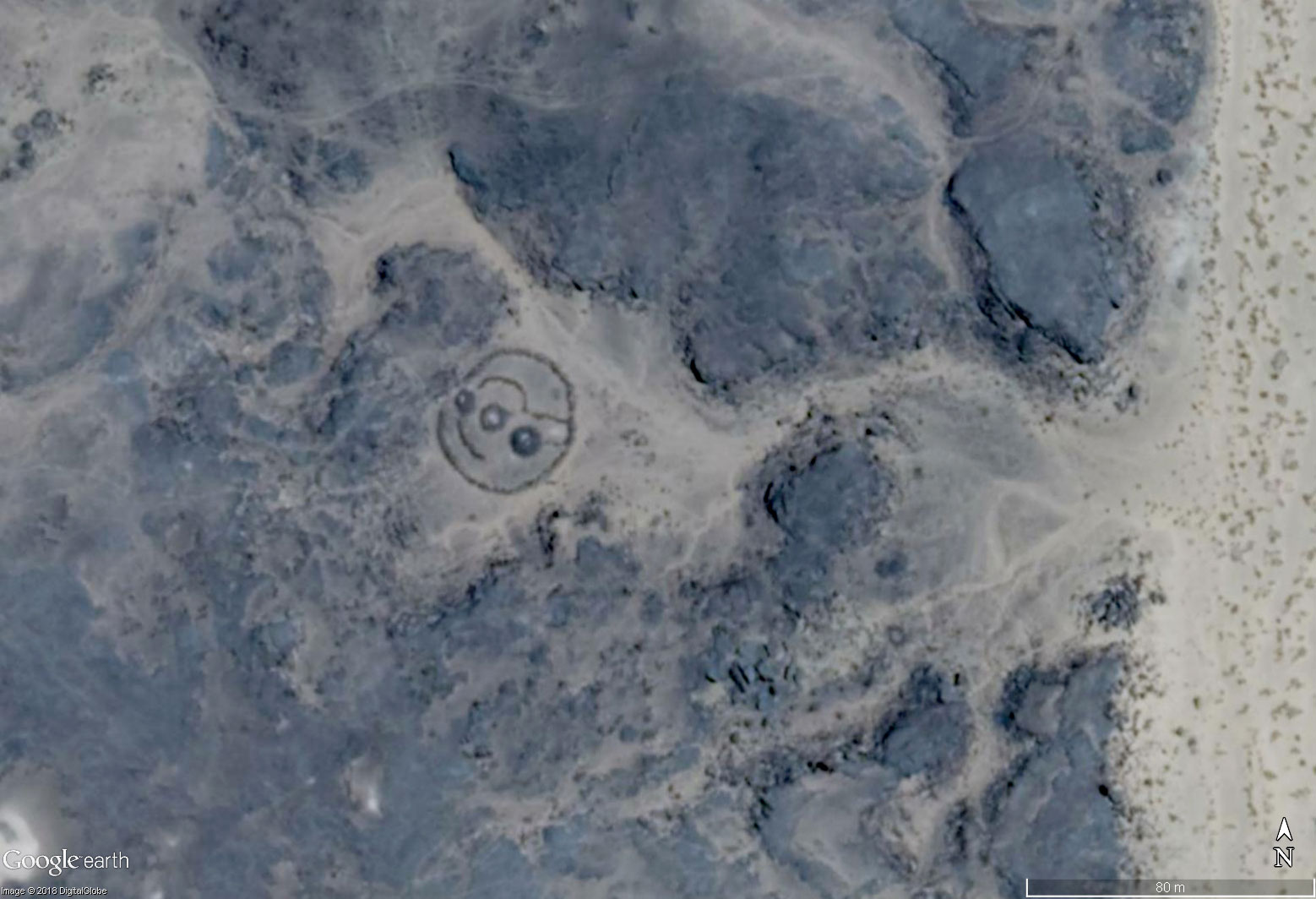
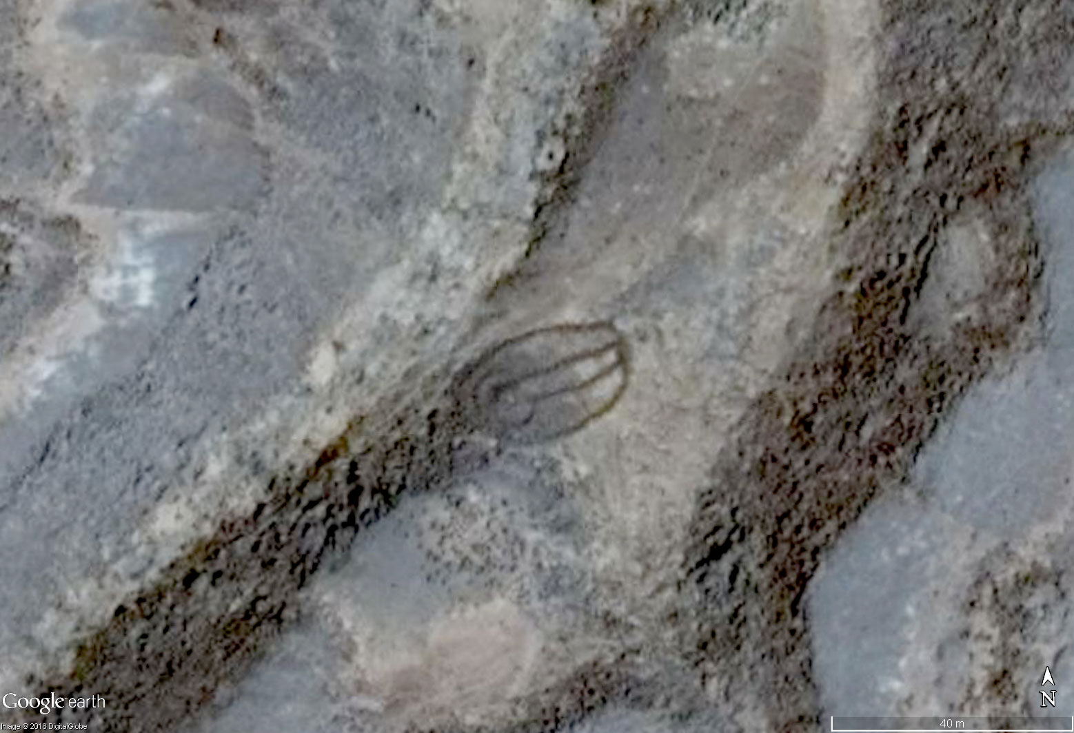
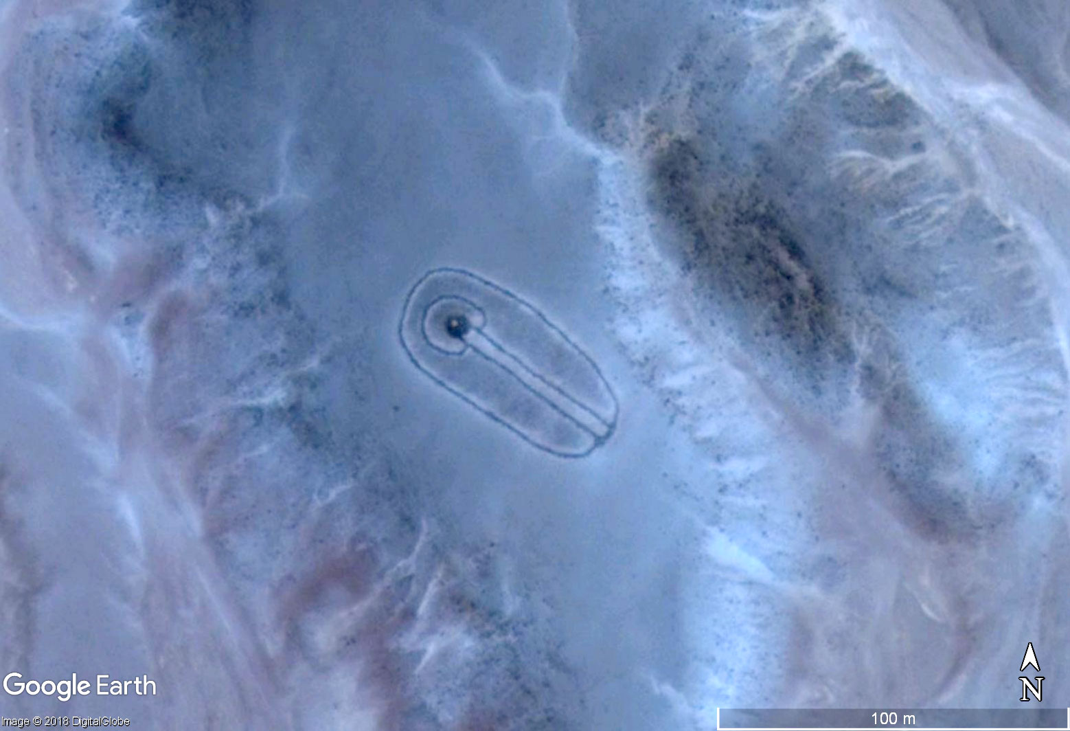
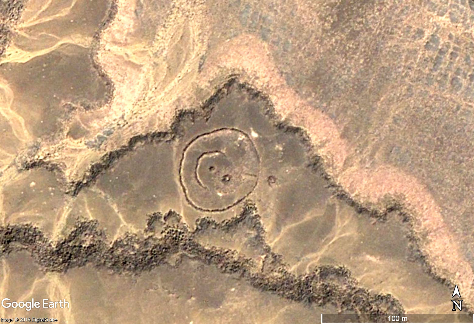
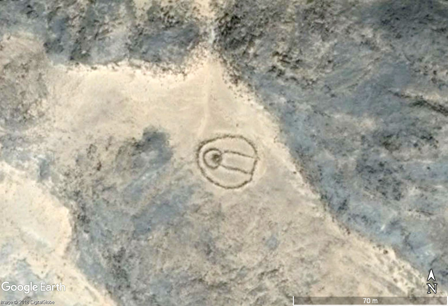
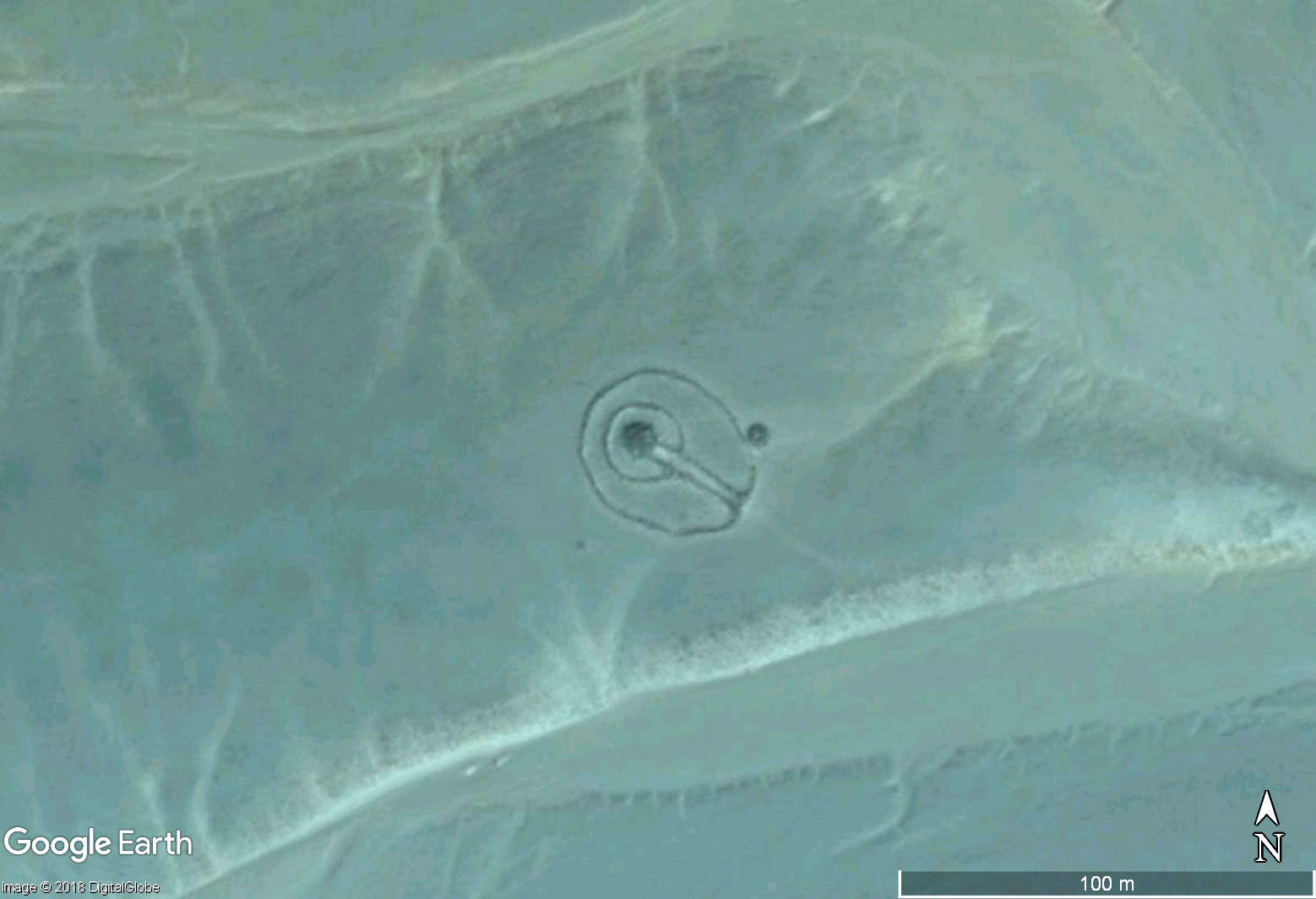
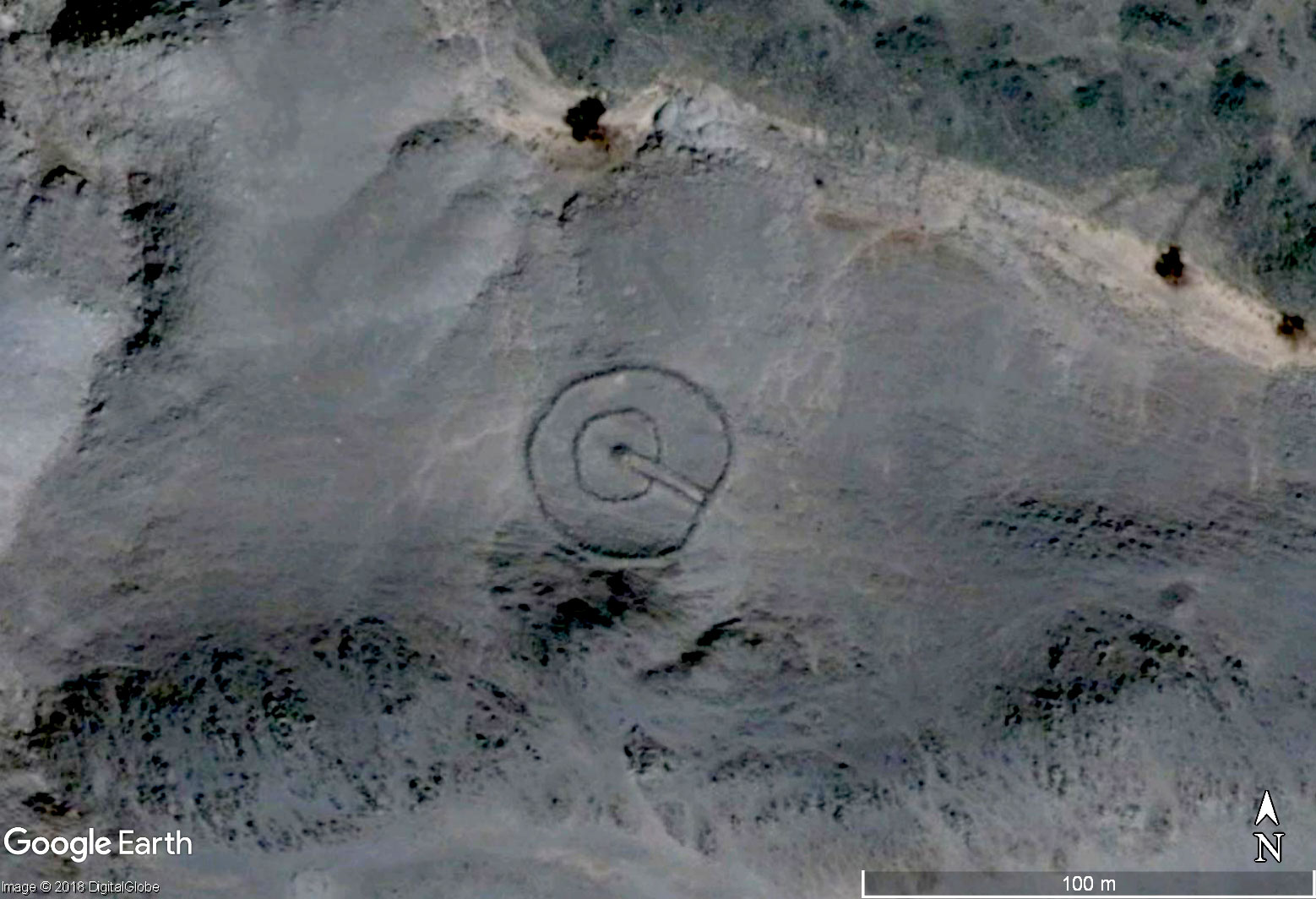
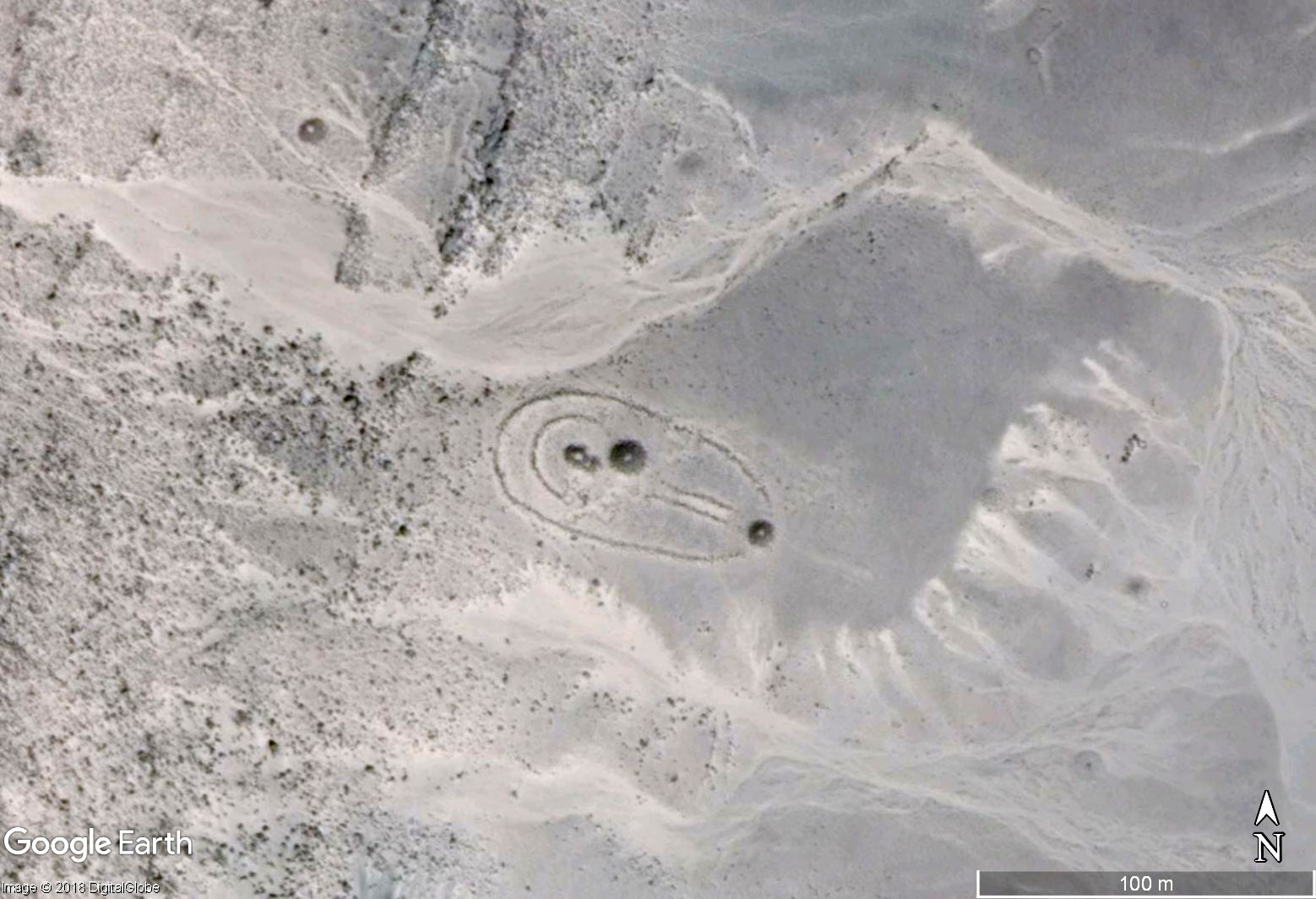
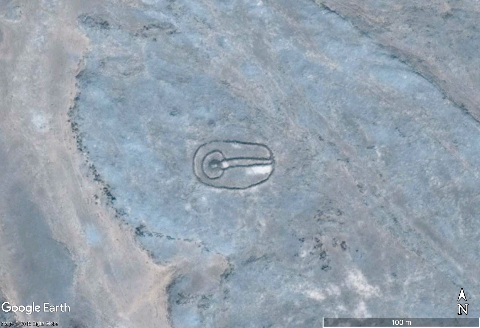
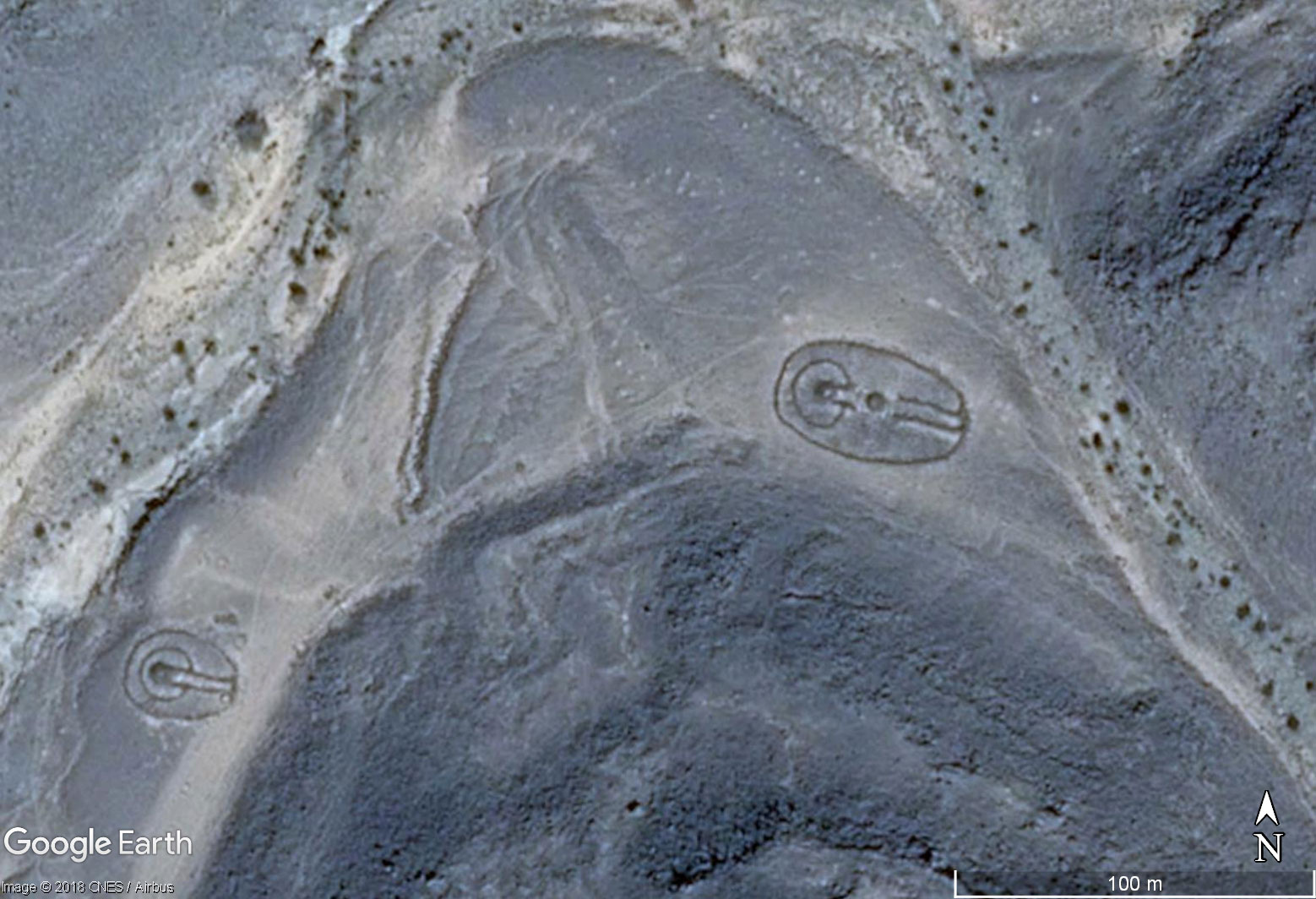
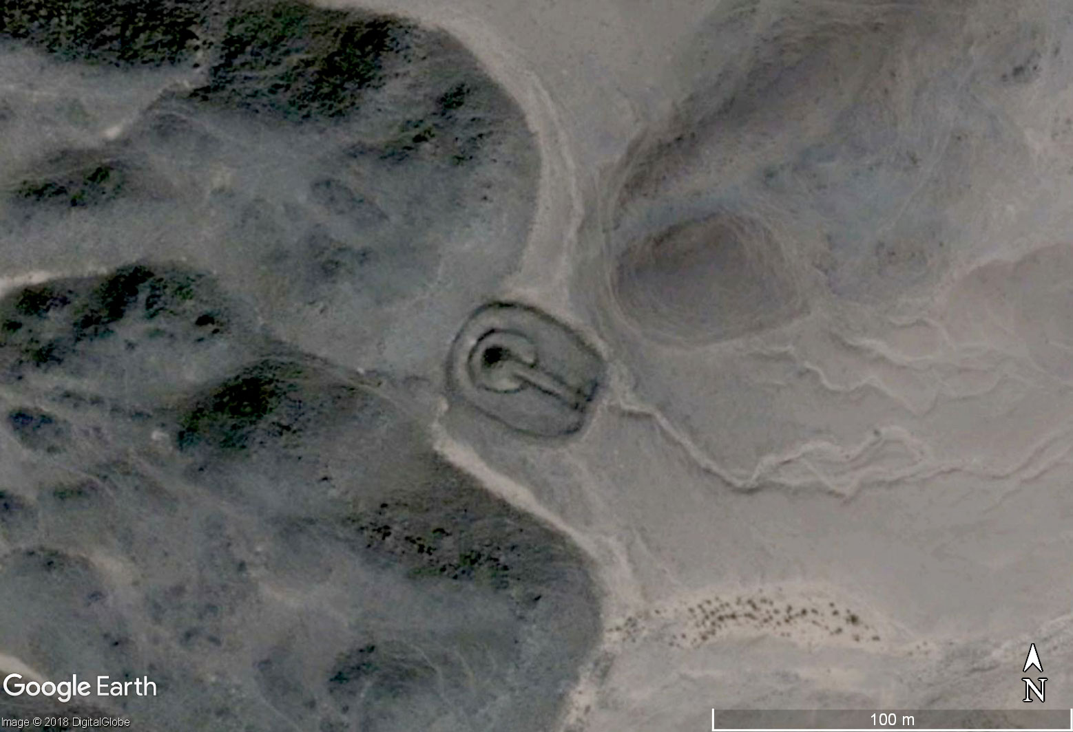
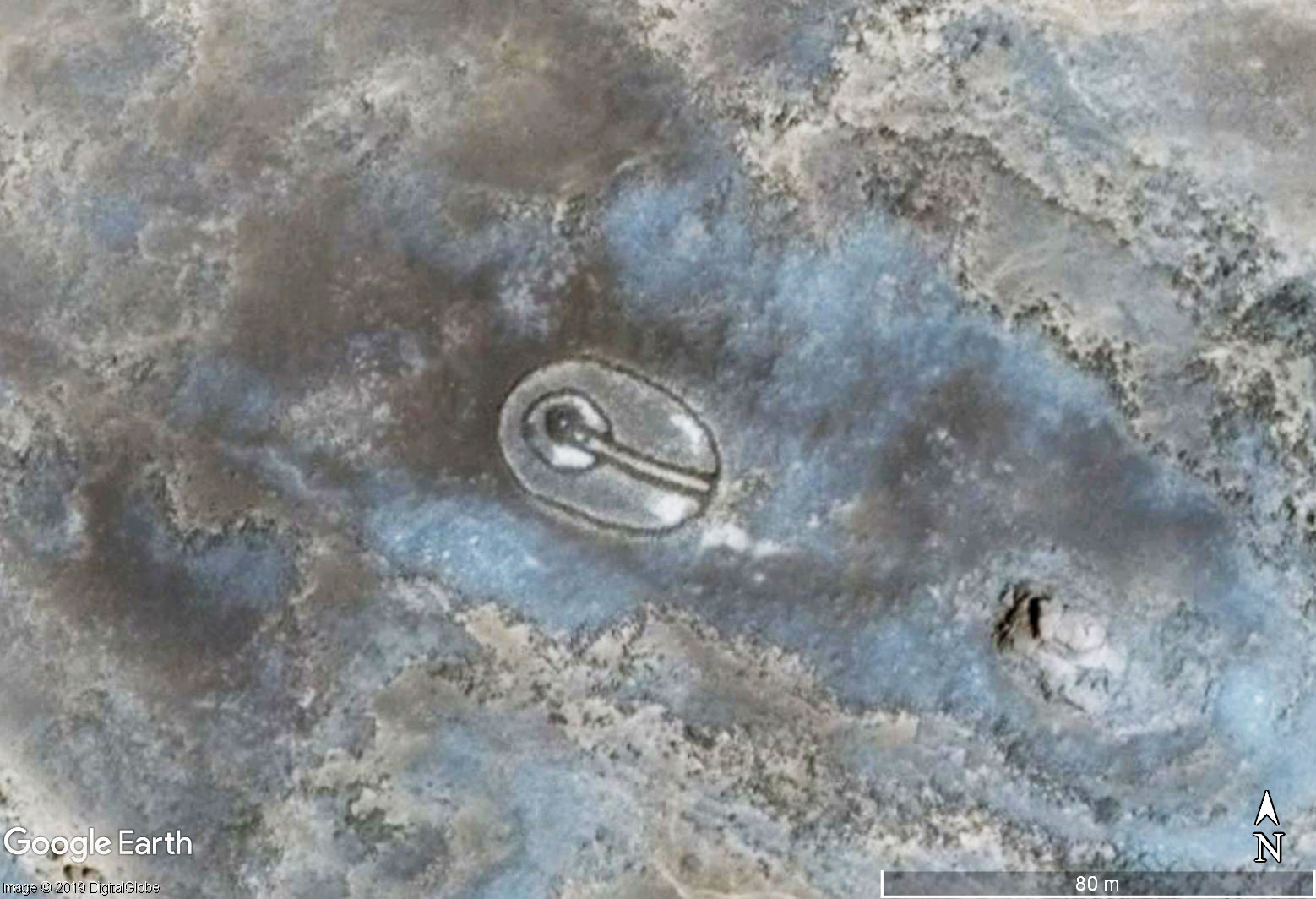
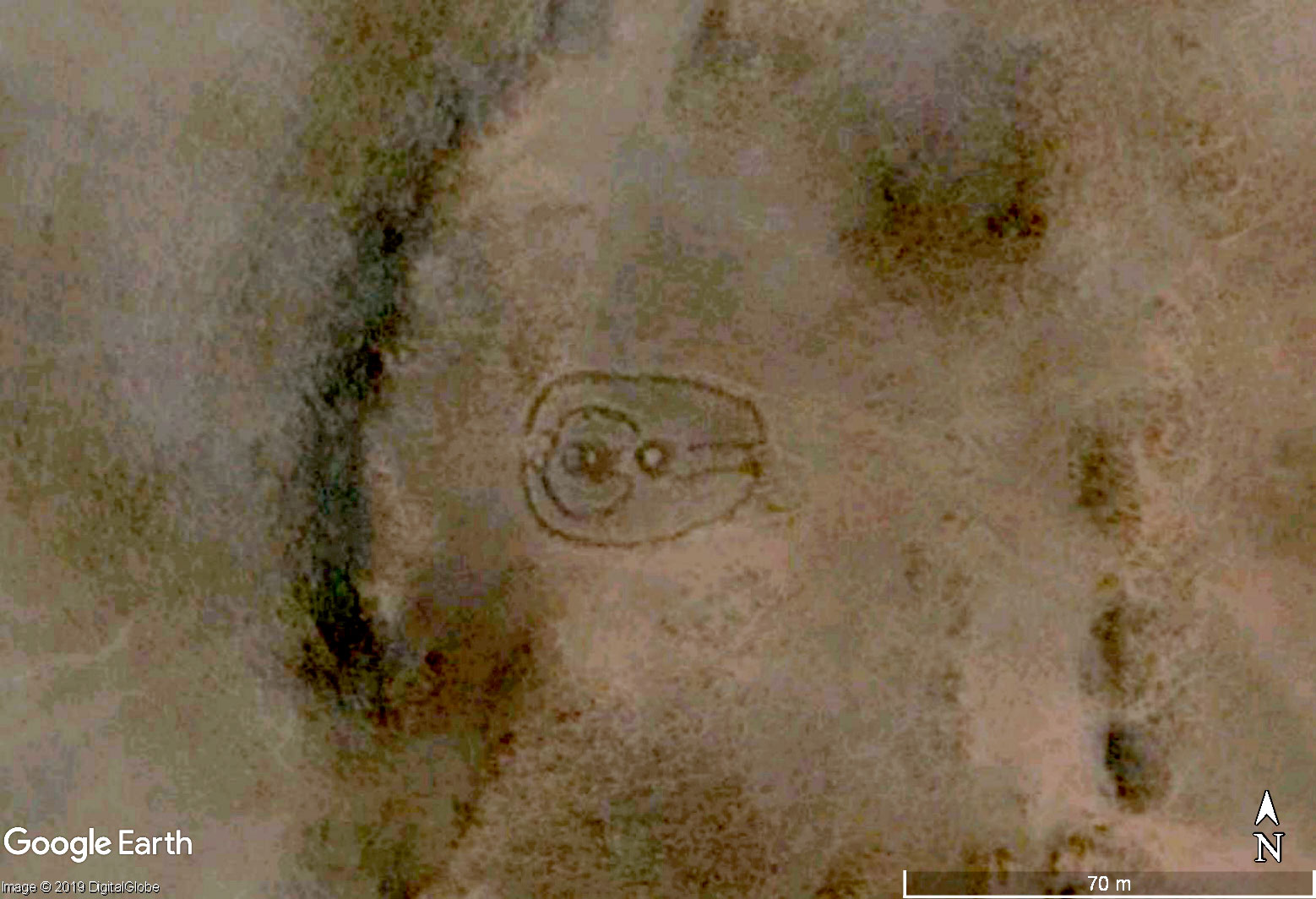
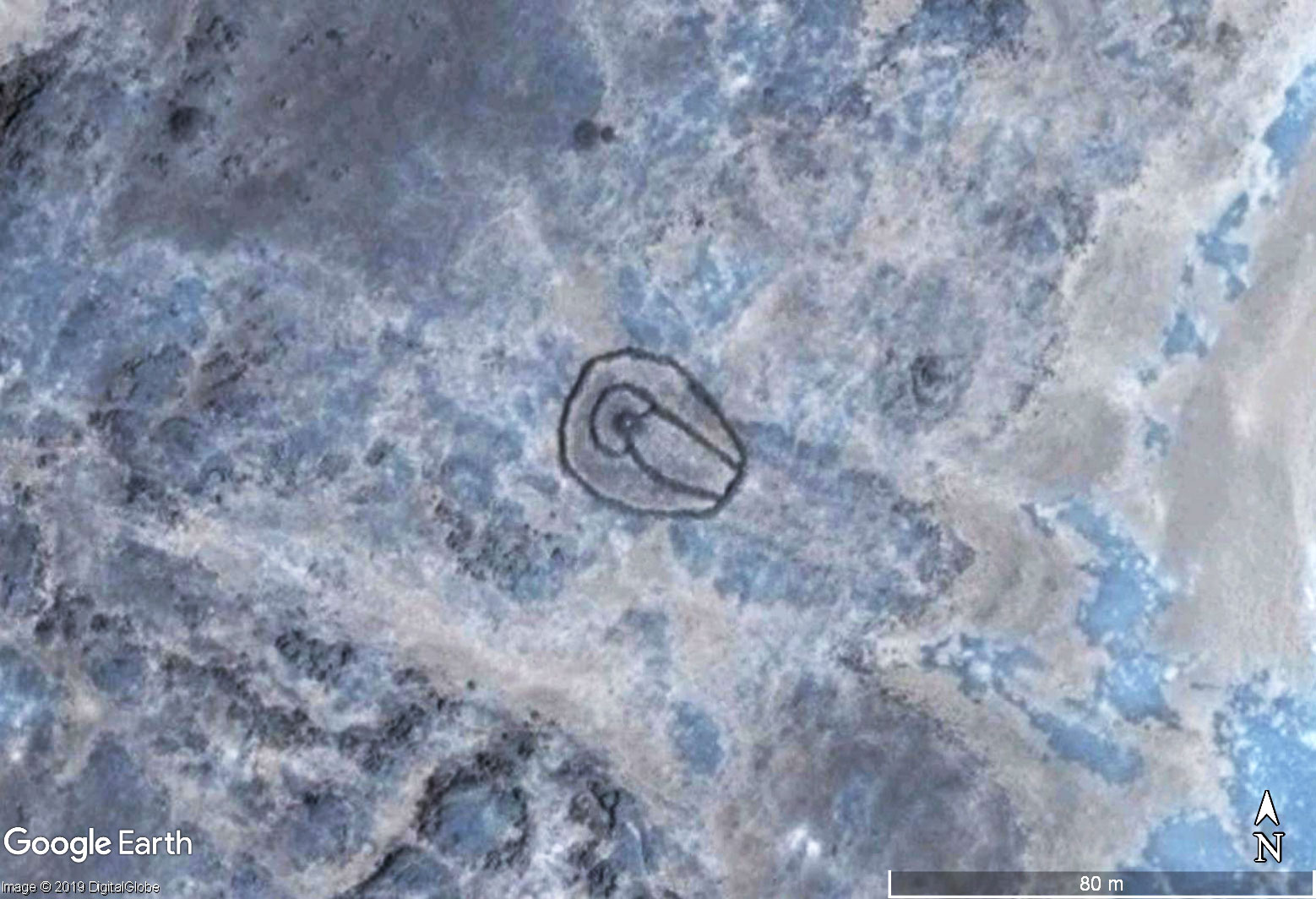
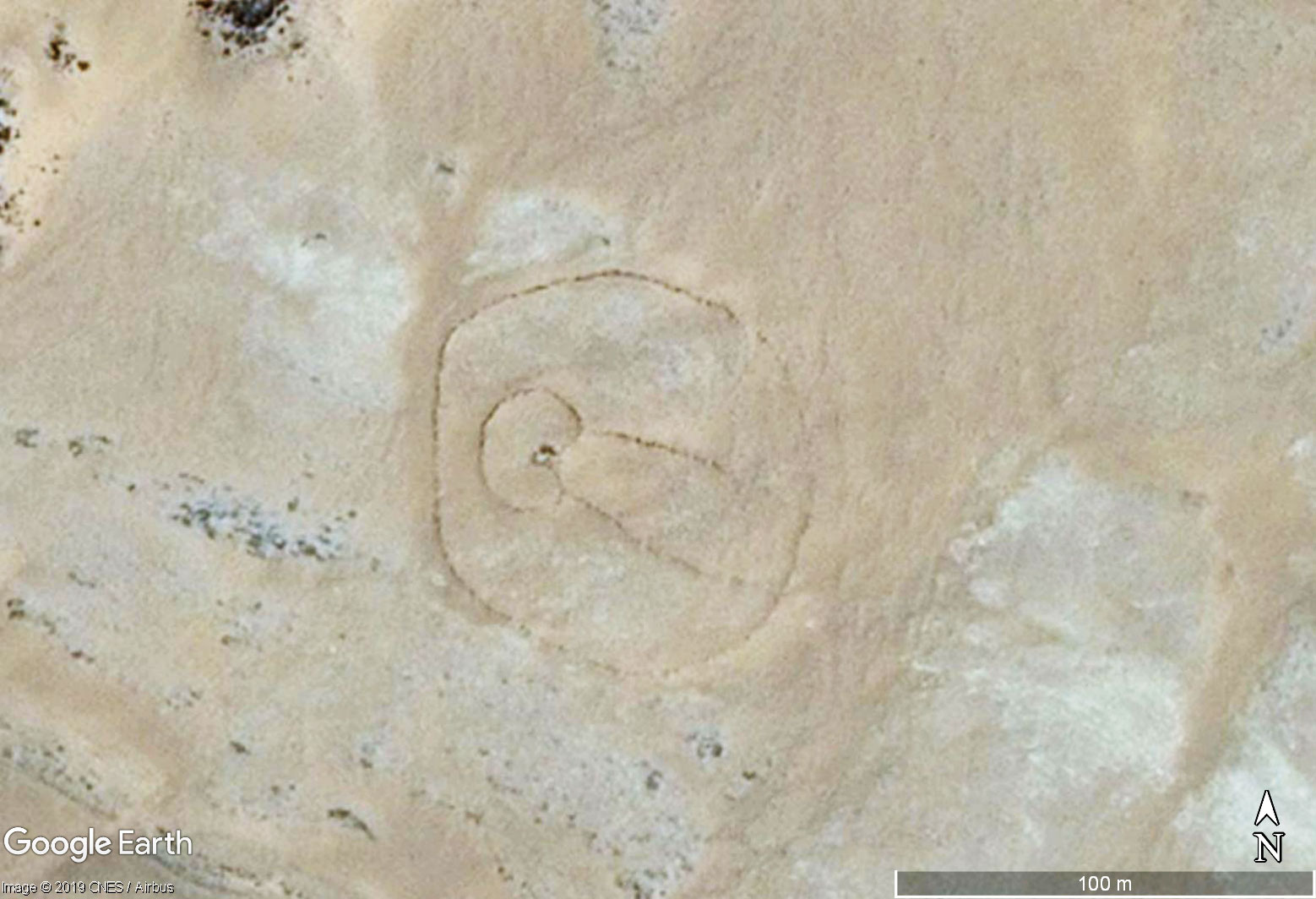
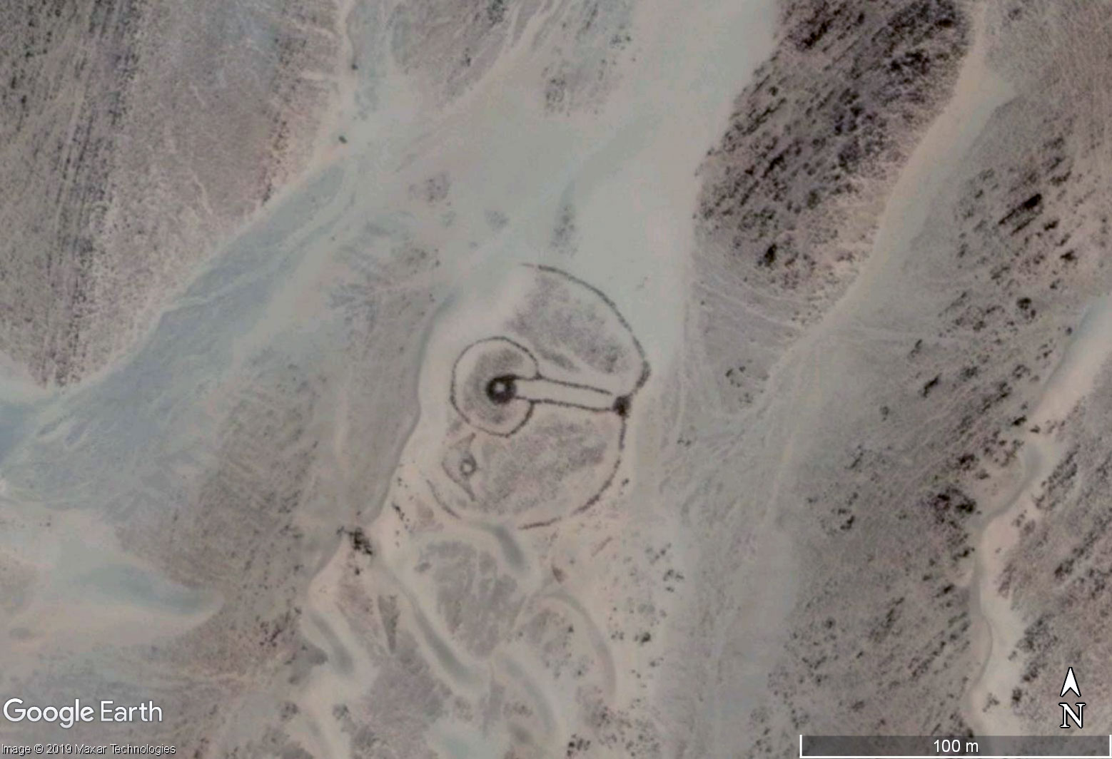
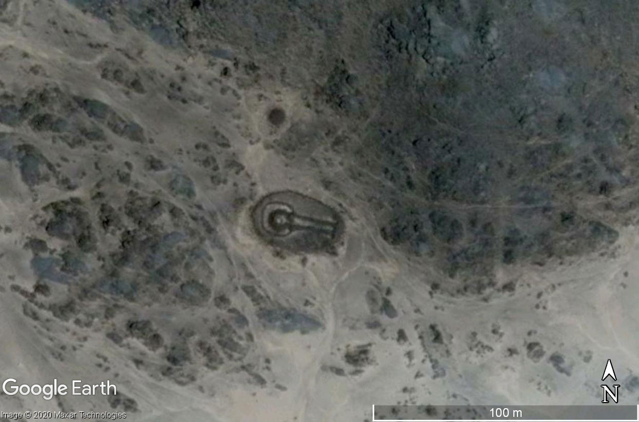
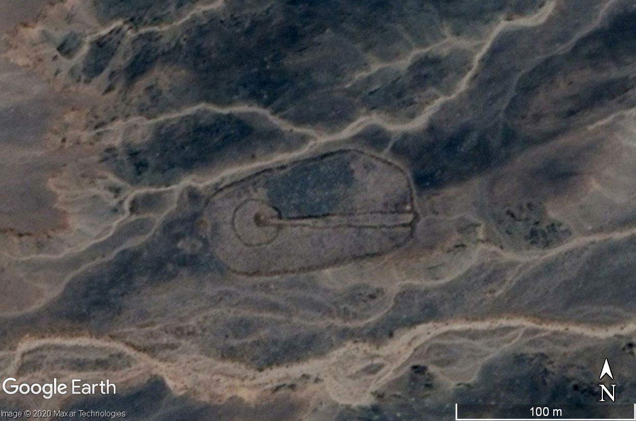
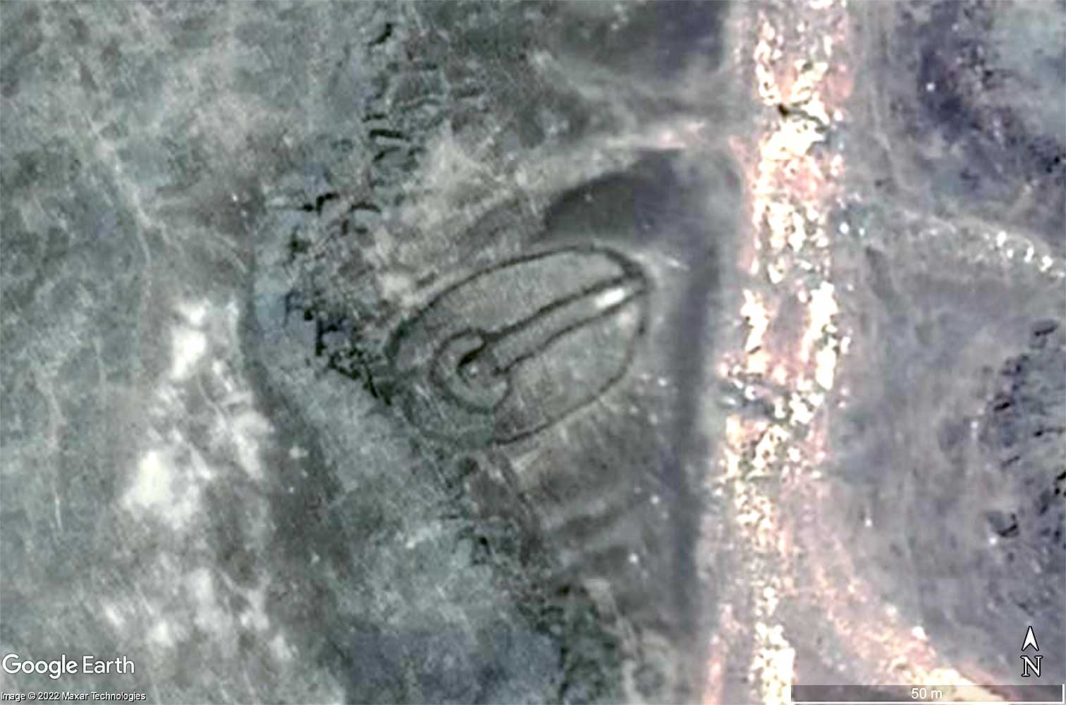
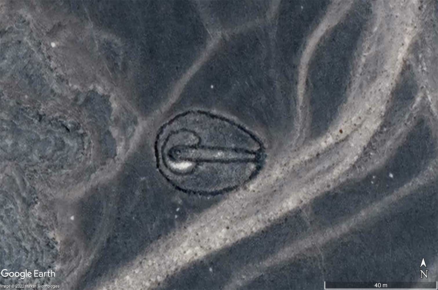
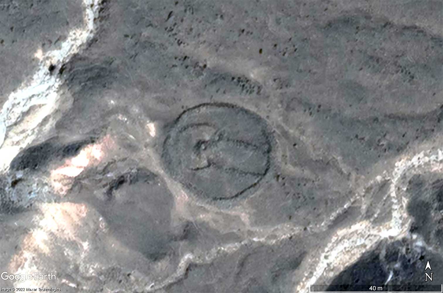
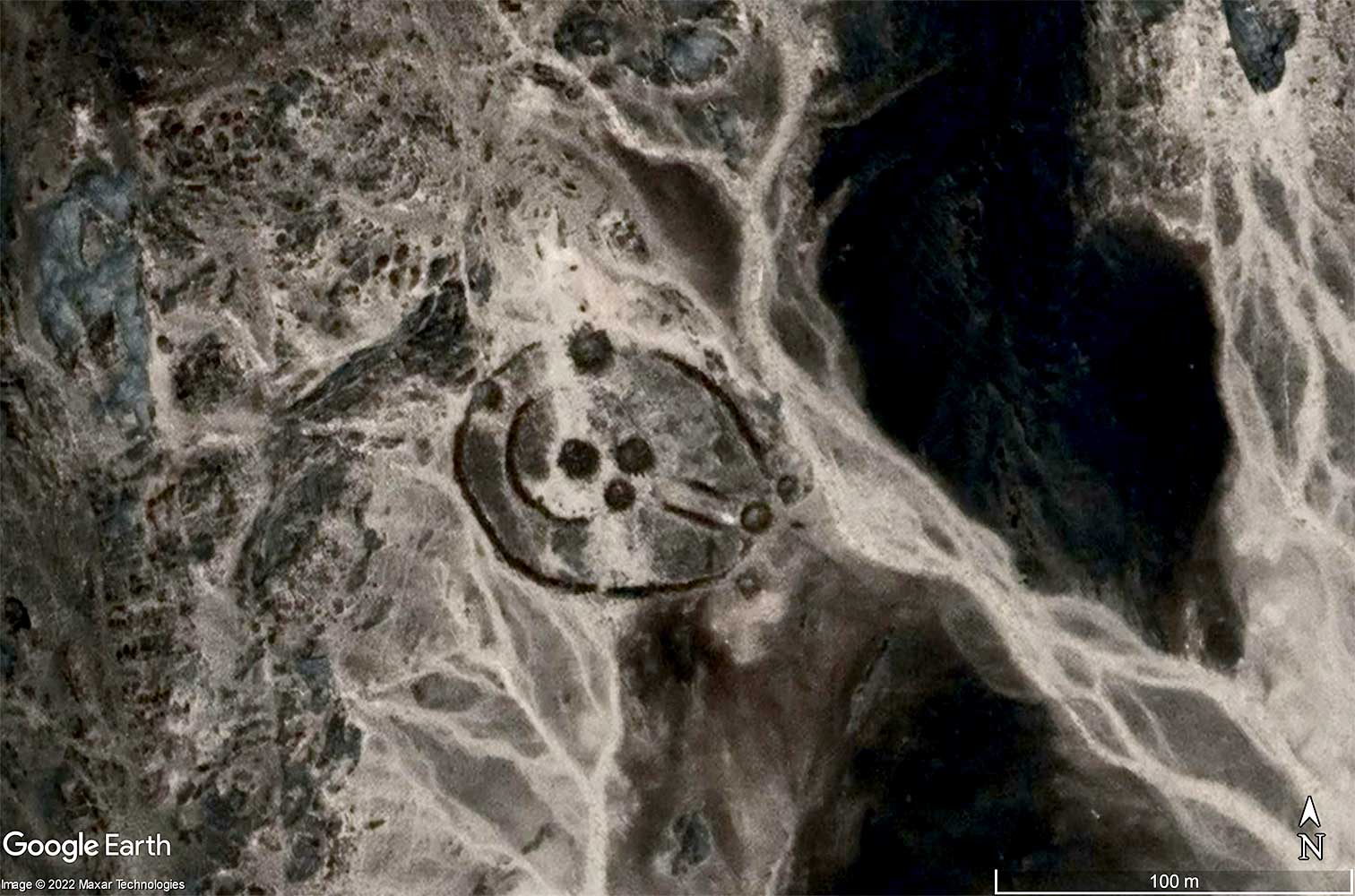
Elaborately constructed stone monuments are scattered all over Tassili N'Ajjer, down to Ahaggar. Its most striking feature is a passage-like corridor leading from a mostly oval outer ring to a circular inner ring with a brick tumulus in the center. Because they resemble keyholes, they were nicknamed "Monuments en trou de serrure" by their French discoverers, which became "Keyhole monuments" internationally. According to current knowledge, these keyholes are probably among the oldest known Saharan monuments. Dating has given an age of up to 7,000 years. Their function remains unclear. Some were tombs, some weren't.
Various patterns:

| 
| 
| 
|

| 
|
| 
| 
| 
|

| 
| 
| 
|

| 
| 
| 
|
| 
| 
| 
|
| 
| 
| 
|
| 
| 
| 
|

| 
| 
| 
|
| 
| 
| 
|

| 
| 
| 
|

| 
| 
| 
|
| 
| 
| 
|
| 
| 
| 
|
| 
| 
| 
|

| 
| 
| 
|
| 
| 
| 
|

| 
| 
| 
|

| 
| 
| 
|
| 
| 
| 
|

| 
| 
| 
|

| 
| 
| 
|
| 
| 
| 
|
| 
| 
| 
|
Images courtesy of Google Earth™
These pictures are only a small selection. All the objects I found are included in the following download (Google Earth required):Download around 4,500 keyhole tomb placemarks >
< Antennas
Goulets >